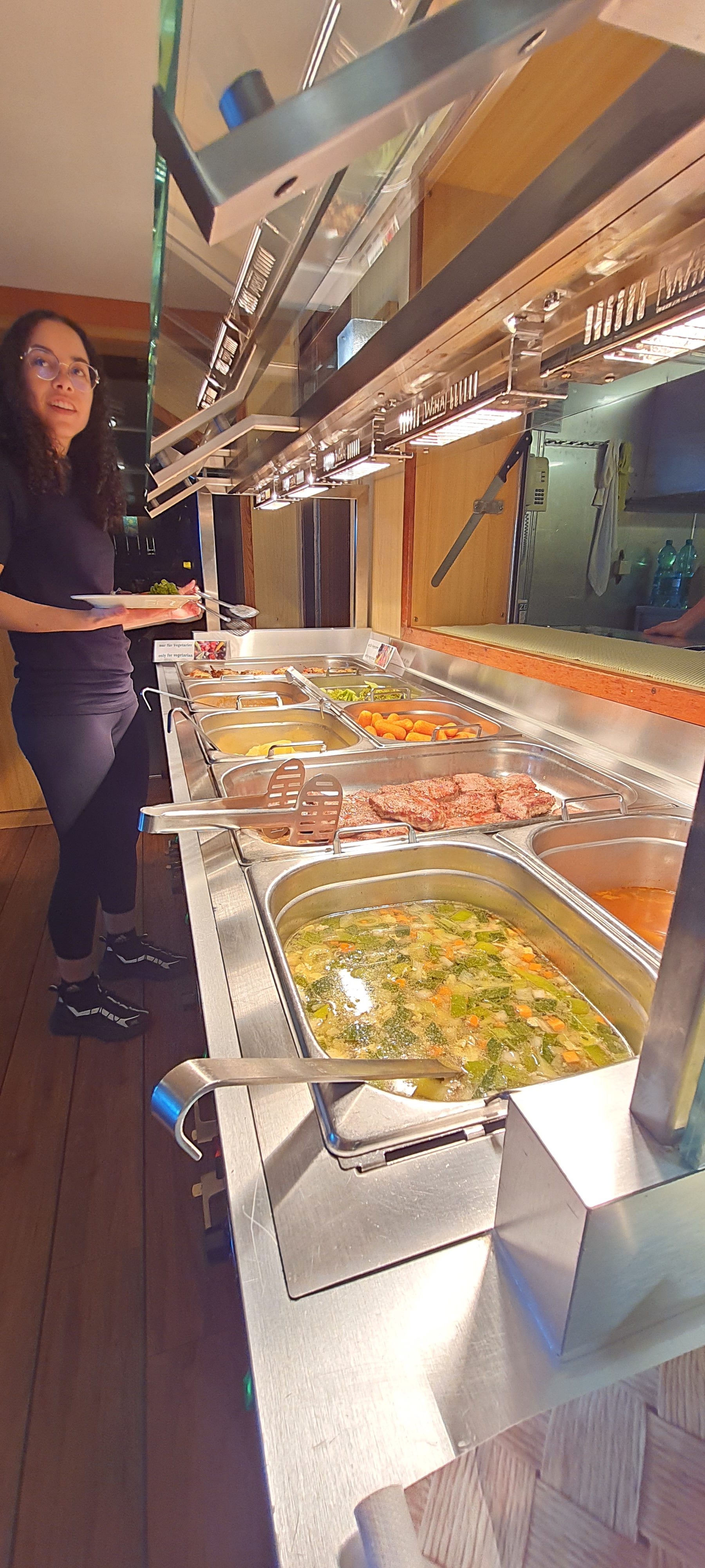
Today marks day 15 of the cruise, arguably the half-way point. To mark the occasion, here are 15 assorted images, one from each day, that might not otherwise have made it onto the blog.


Today marks day 15 of the cruise, arguably the half-way point. To mark the occasion, here are 15 assorted images, one from each day, that might not otherwise have made it onto the blog.


Today we moved further in towards the Amazon, leaving far behind us the shelf beyond which we had had depths of over 4,000m, and into shallower waters. First thing this morning, the Atlas Parasound P70 from Atlas Hydrographic GmbH was used by Rami Kalfouni to profile the sea bed, and results indicated a lovely muddy bottom at 750m, perfectly suited for station leader Mark Zindorf’s MUC deployment. Given the teething problems he and Sarima Vahrenkamp have experienced recently, and a seabed that has proved extremely reluctant to give up any samples, it looked like this could be a good station for the MUC.
It was not to be. This time it was not the depth, nor the sea bed, nor the equipment that caused the problem, but the current, which turned out to be too strong to make a safe deployment possible. The positioning systems on the Meteor are wonderful, but nothing can prevent a heavy piece of equipment from moving laterally as it descends on a steel cable to such depths in strong or unpredictable currents. In addition, the MUC could embed itself in the sediment, the effects of the current making it impossible for it to be retrieved cleanly. With it acting as a type of anchor, the cable could be placed under strain, or perhaps the equipment could be dragged along the bottom before coming free. There was therefore a clear risk to the multicorer, and at worst to the winch or even to the ship itself and those in it. In short, deployment of the MUC and the Bottom Water Sampler had to be cancelled.

Frustrating as it is, everyone knows that safety comes first, and we are now looking forward to the next station, with no unpleasant currents and a sea bed that is… not too hard and not too soft, but just right!
Since conducting my PhD research on the Amazon and Pará River estuary in the wet season, the river mouth, together with the mangrove belt to the south, has been an area of special interest for me. I recently participated in the land-based PROBRAL campaign to collect water from the mangroves and smaller rivers such as the Caeté (see Mud and Mosquitoes).
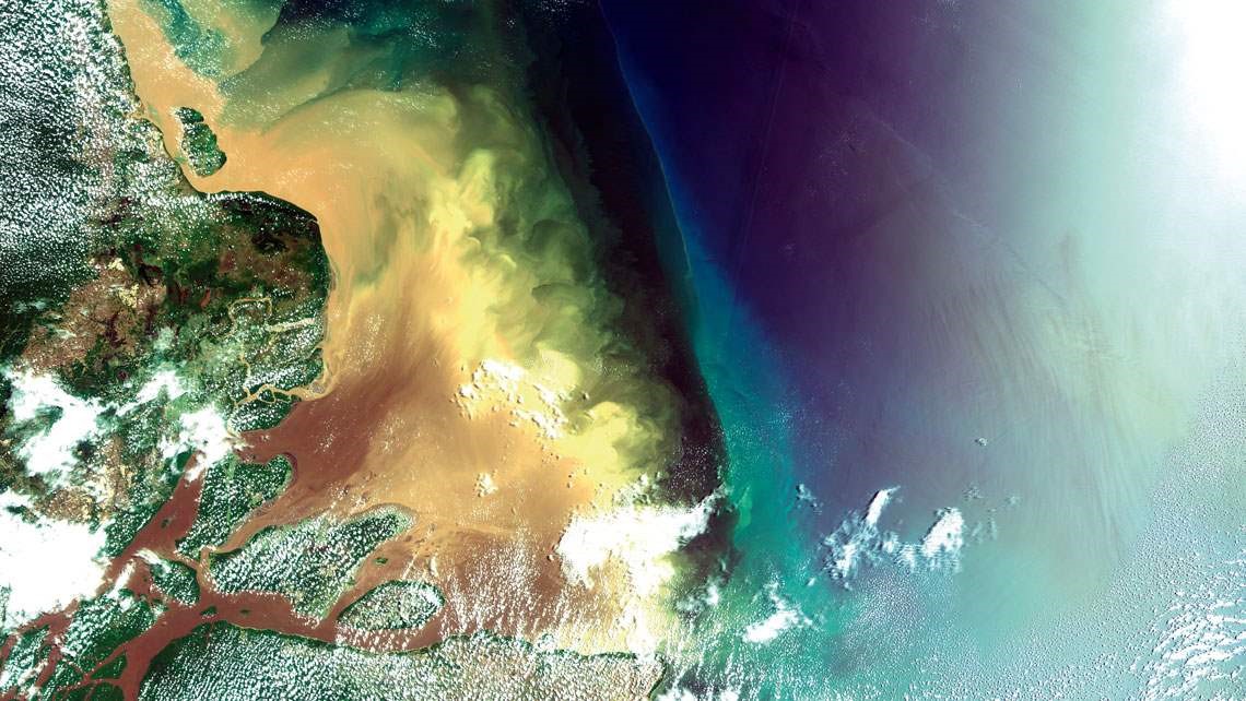
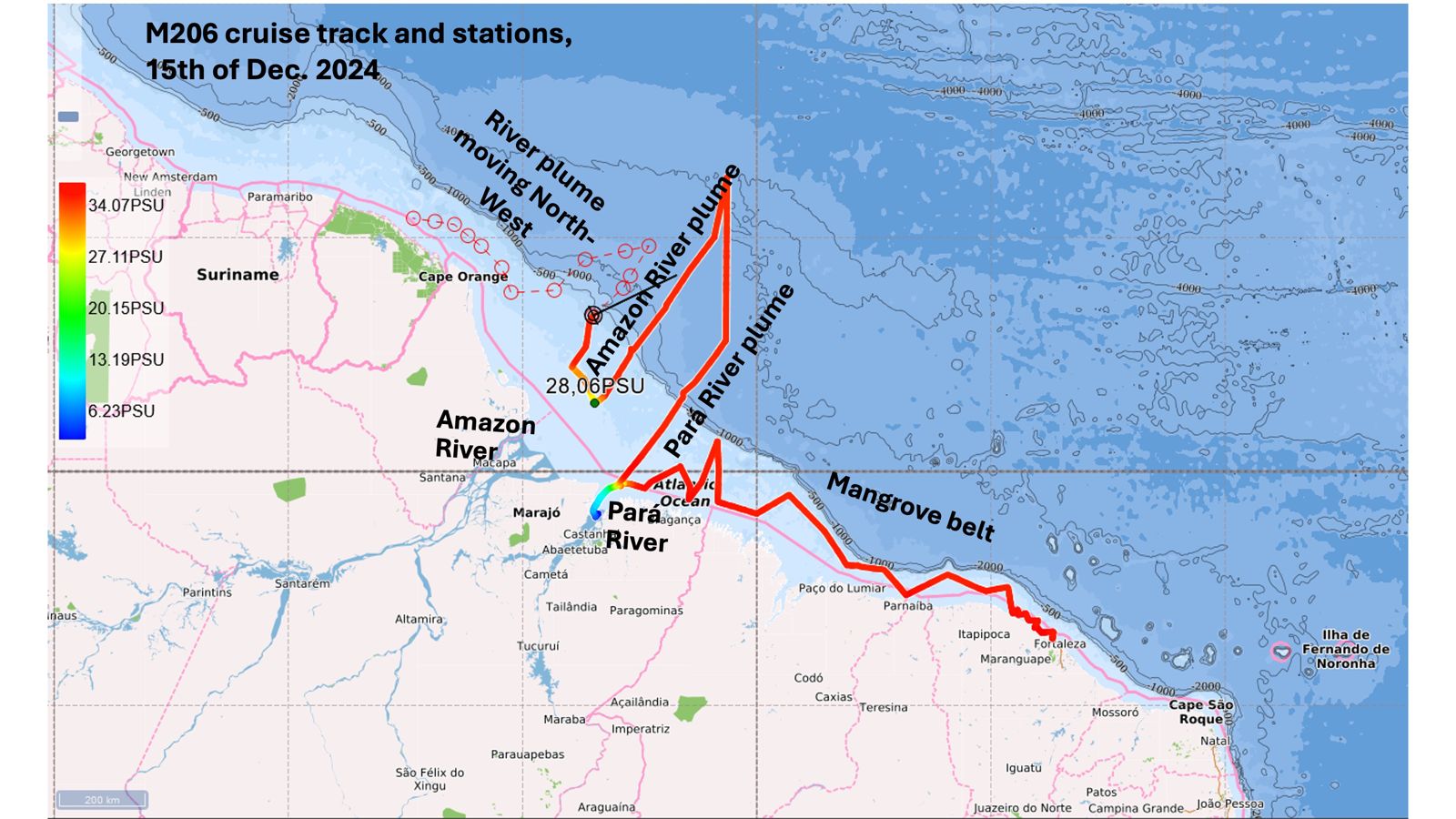
M206 will add to the results gleaned from research on previous wet-season cruises (M147 in 2018, and M174 in 2021) by gathering a much-needed dataset for the dry season, since the Amazon and Pará River flows vary dramatically in volume (from 120 000 m3/s to 240 000 m3/s for the Amazon; 38 000 m3/s to 9 000 m3/s for the Pará). We have not yet entered the Amazon River estuary itself on M206, but we see is a striking visual difference on the Pará today compared to its appearance in the 2018 wet season (April/May).
In addition, we have made a more extensive transect along the mangrove region in cruise M206 compared to M147 and M174, in some cases running parallel to the region where the PROBRAL samples were collected. The paradoxically higher salinity near the coast in the mangrove-belt region of M206 (as reported in earlier blogs) may reflect what we observed in the mangrove porewater collected during PROBRAL 2-3 weeks ago, which was sometimes much higher than seawater (up to 65 PSU).
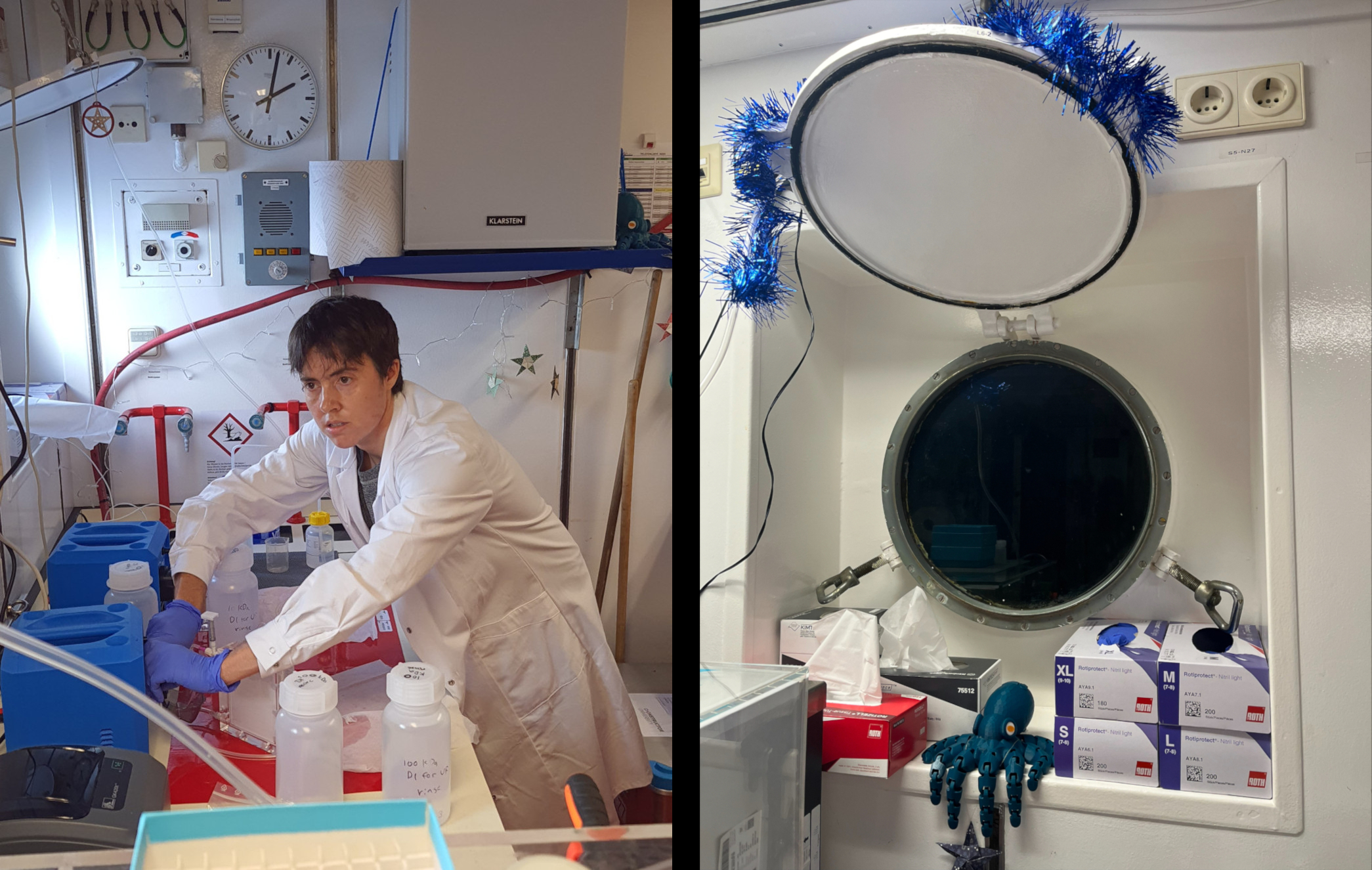
Our previous research on the Amazon-Pará estuary has focused on trace metals (Fe, Co, Ni, Cu, Zn, Cd, Pb) and metal-organic matter interaction. Metals such as Fe, Co, Ni and Zn are heavily complexed to organic matter (a.k.a. organic ligands), which can influence their solubility, toxicity, and bioavailability. In addition, metals and organic matter come in different sizes, which influences how much they remain in the water column and eventually reach the ocean during estuary mixing. On the ship lab on M206 as well as PROBRAL, my own work has focused primarily on filtering and processing seawater samples for trace metals, Cu and Ni-binding organic ligands, humic substances (a major fraction of terrestrially-derived organic ligands) and dissolved organic carbon. In addition to the samples that are already filtered by the team in the clean bubble, we also do further filtering at different pore sizes..
This data, combined with the bottom-water and MUC data, will provide a clearer picture of the processes taking place throughout the water column and salinity gradient during estuary mixing.
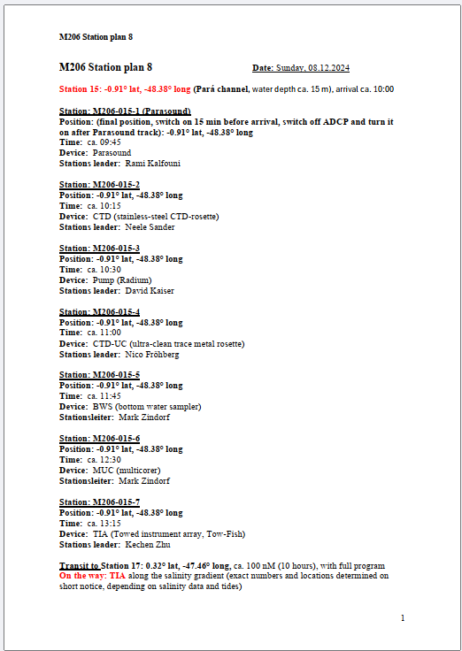
A full day today, as we head out from the mouth of the Pará River near Belém on a 10-hour run with sampling stations along the full length of the transect.

Brought here as always with perfect timing and positioning by Captain Rainer and crew, we start from a point just off the main village of the island of Colares (pop. 12,000, made famous because of the Colares UFO sightings of 1977), with a full complement of stations to perform starting at 09:45 local time. This will include the MUC, when we can be (reasonably) assured this time of finding some interesting samples. Photos to follow!
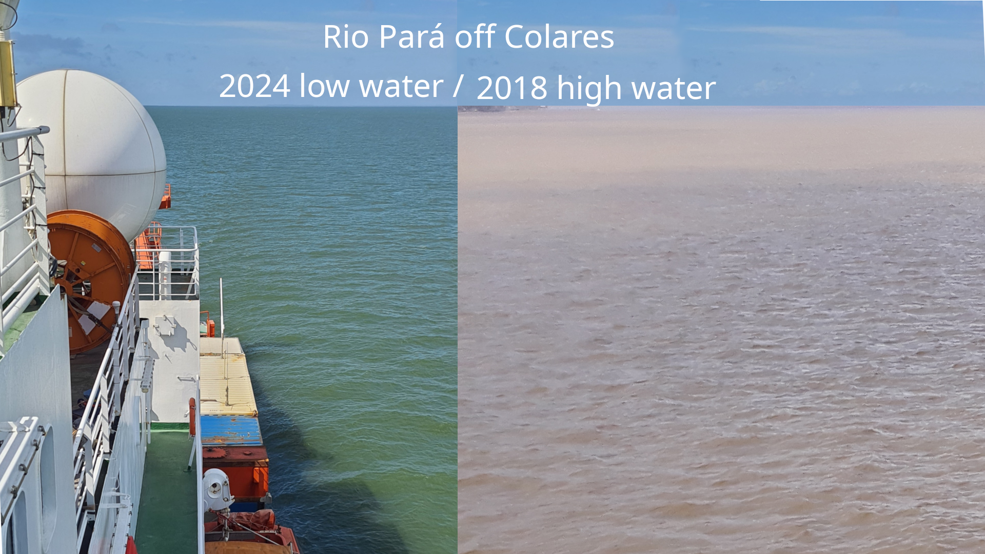
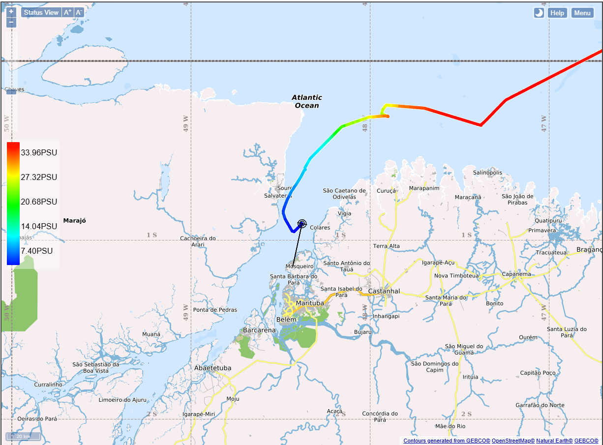
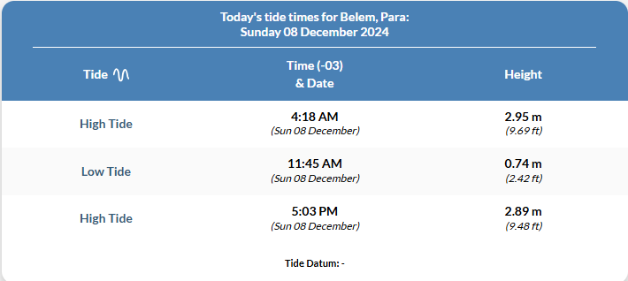
As we sailed upriver, it was interesting to see that the water is relatively green, even now, within 90 minutes of low tide; and in spite of the salinity declining as expected (map). This is quite a contrast with the M147 cruise in 2018, at high water (inset picture).
The weather has being kind to us so far, although the forecast is for lots of thunder and lightning. For the moment, however, we seem set for a profitable sampling run!
Although we have had a few minor problems with first use of the sampling equipment, this is budgeted for in the station planning, and everything is now tested and functional. Things can still go wrong when dealing with sensitive equipment, but everyone is confident that any small problems can be speedily dealt with.
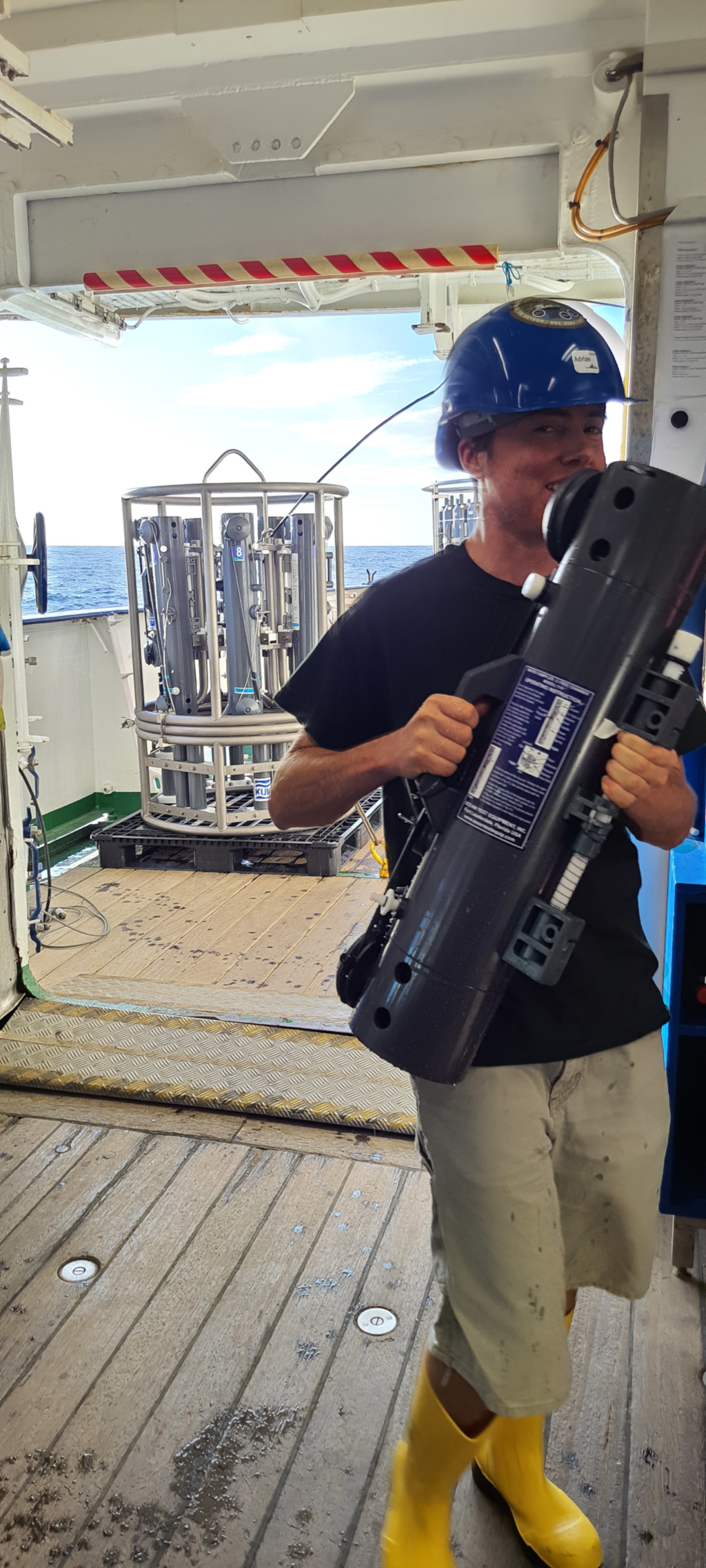
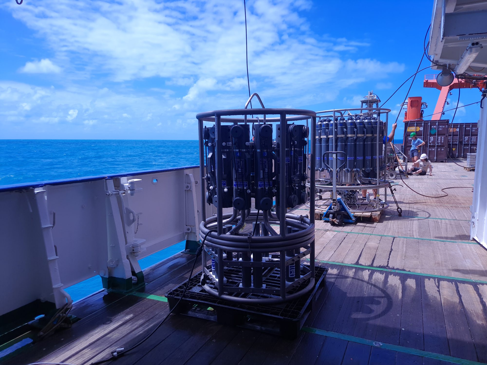
Today and tomorrow, we will be working with all the main sampling instruments: the CTD, the MUC, the BWS, TM-CTD and the tow fish (all pictured). There are two great short videos that show the mechanisms of the MUC and the CTD in operation underwater – one from the Schmidt Institute, here; and the other from Geotraces/PolarTREC, here.
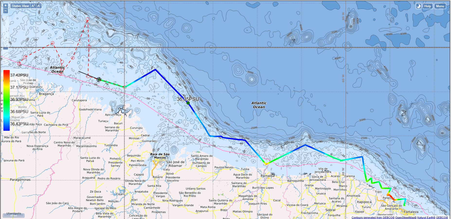
We have moved now approximately 300nm (550km) west long the coast, zig-zagging in order to sample along the salinity gradient. It is interesting to see that the salinity is extremely high close to the mangrove coastline (on the map, red is most saline and blue is least saline): it is not clear whether this is a normal condition during low water or is exaggerated due to the extreme drought experienced in the Amazon region this year.
The Meteor unmoored and left Fortaleza this morning before 09:00, and we are now sailing for our first sampling station. We are leaving the coast 10 km behind, and in the bright sunshine the water is very blue. We expect to to encounter first green water and then brown water as we go north and get closer to the Amazon river mouth. As we approach our stations along the mangrove region, and close to within a kilometre or two of the coast, we may also see a change in water colour.

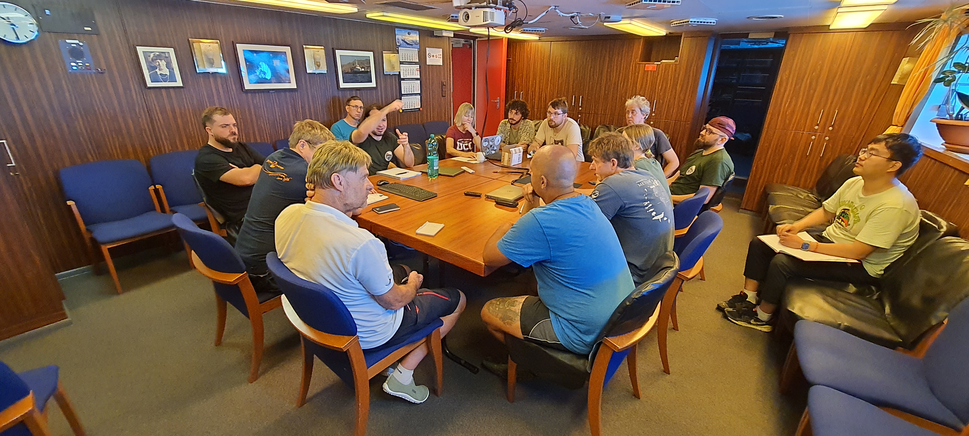
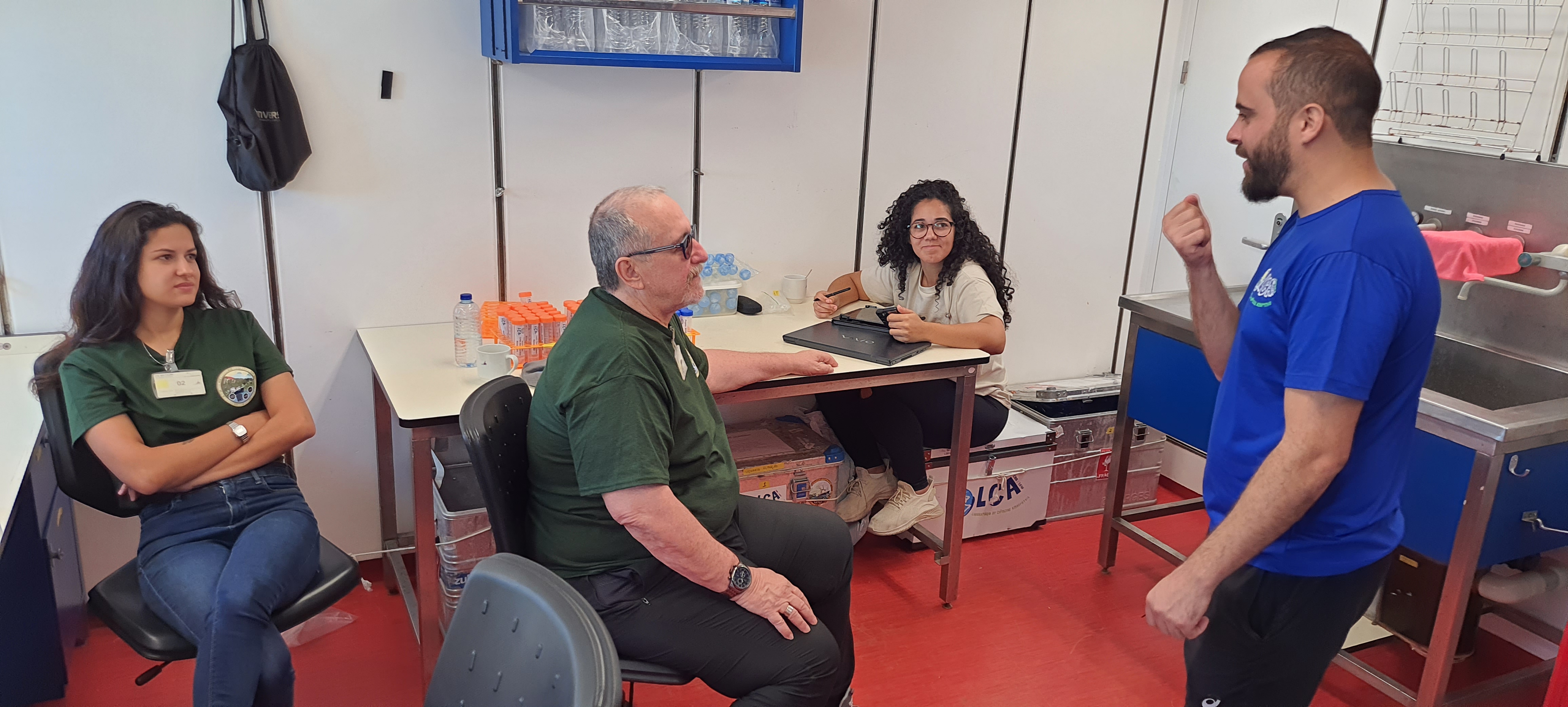
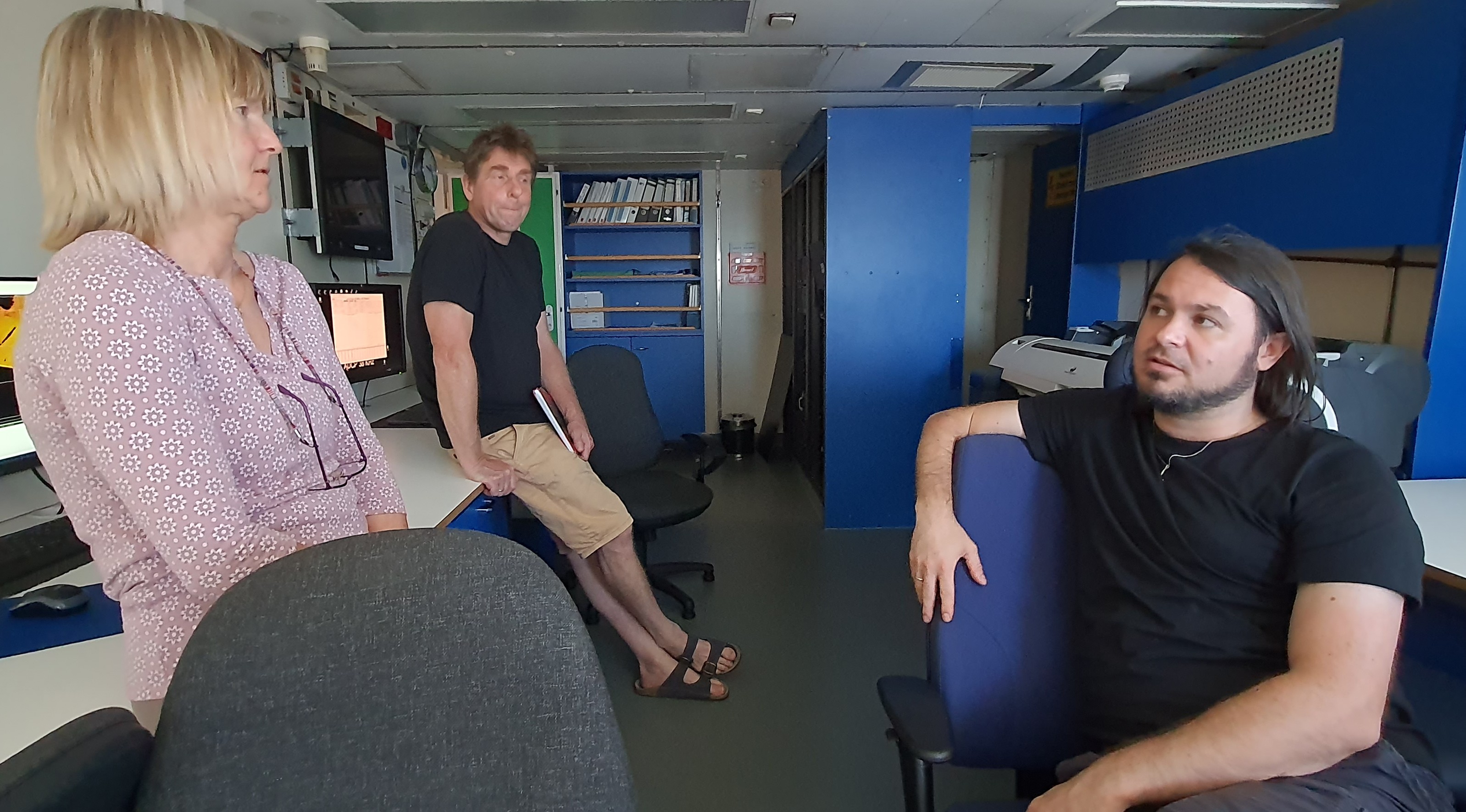
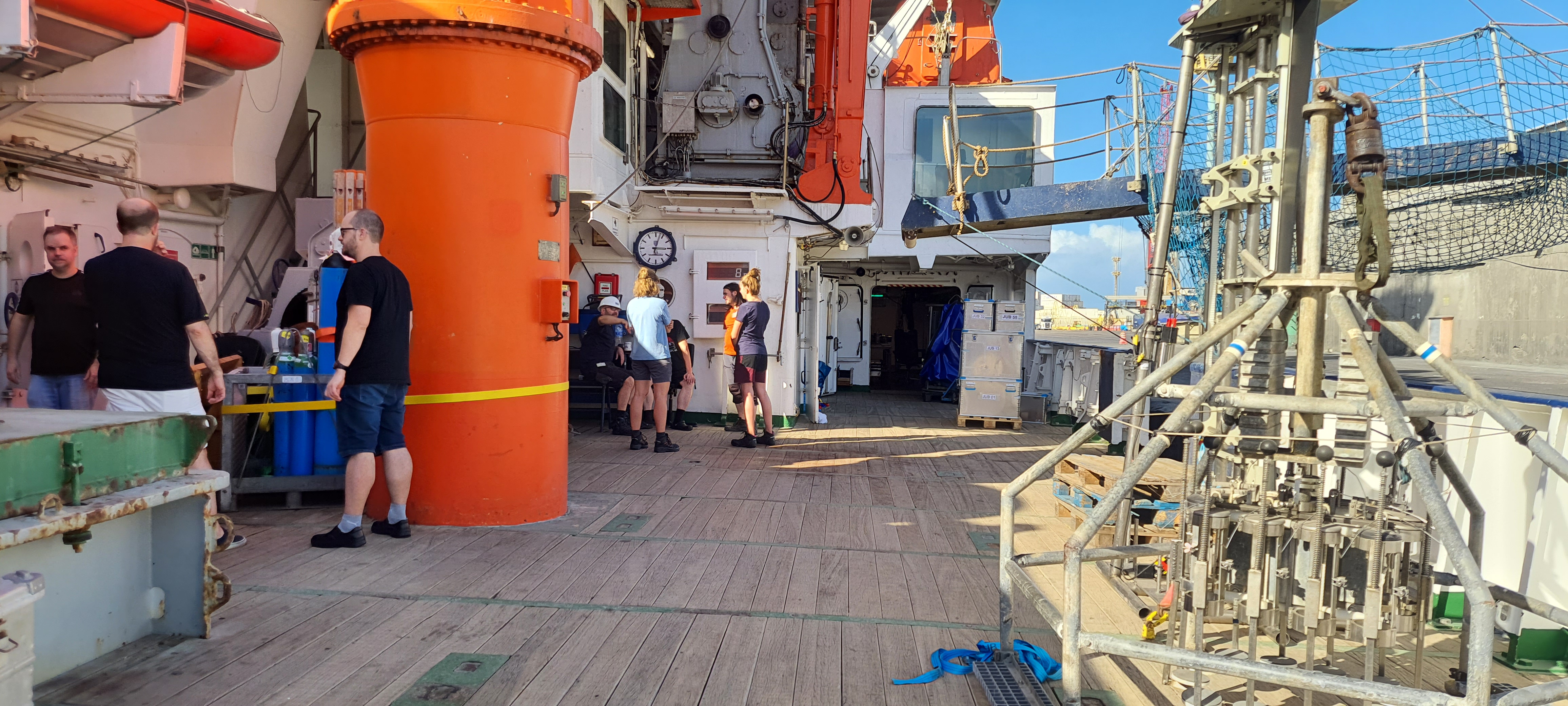
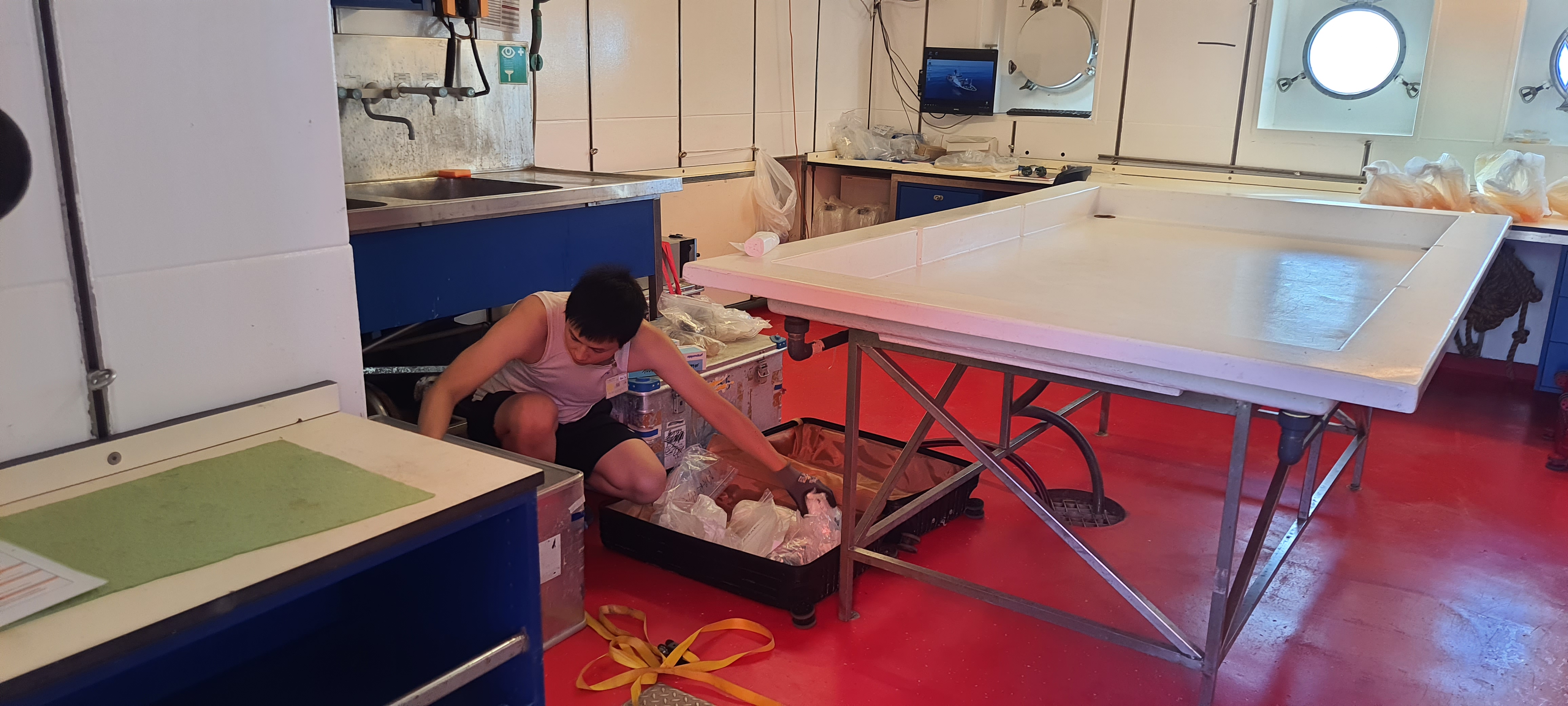
Meanwhile, the scientists have been hard at work and most of the equipment and labs are now organised and ready for the sampling stations. This includes the CTD and MUC samplers, which we will detail in the next posts, and there is a buzz of excitement around the ship as we begin our work in earnest, and this requires careful planning to make the best use of time and money. There is also already some filtering and analysis being done of water samples taken during the PROBAL programme just before M206. Here, a station meeting is in progress to discuss the details of the correct deployment of equipment for the first station tomorrow morning at 08:20.

Outside, work goes on all day and night for the captain and crew. Although we are at the beginning of the wet season in the Amazon, here, further south, we have wall-to-wall sunshine, and temperatures even 10km from the land are around 30 degrees, and a lot more if you’re not in the shade. We have to be careful and take suitable precautions when we go on deck for any length of time.
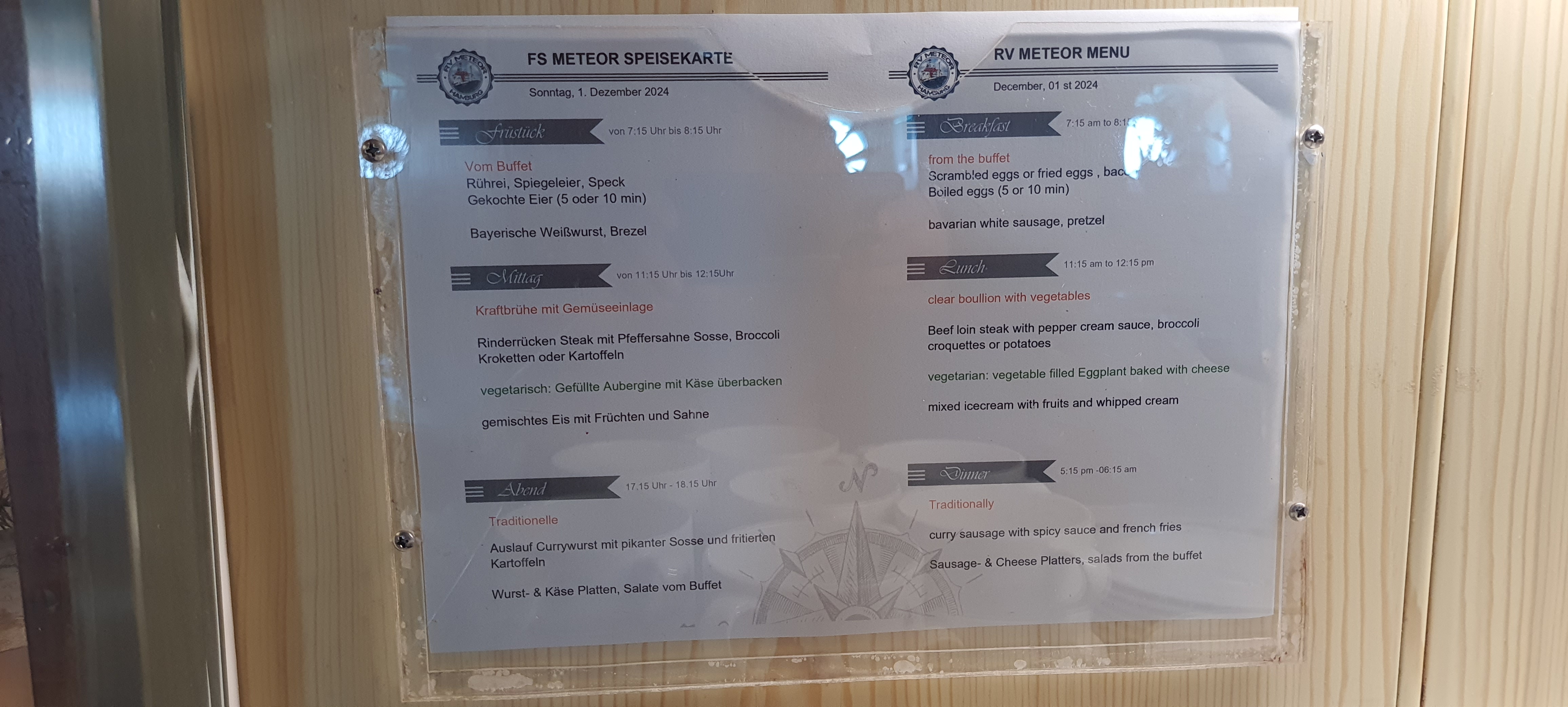
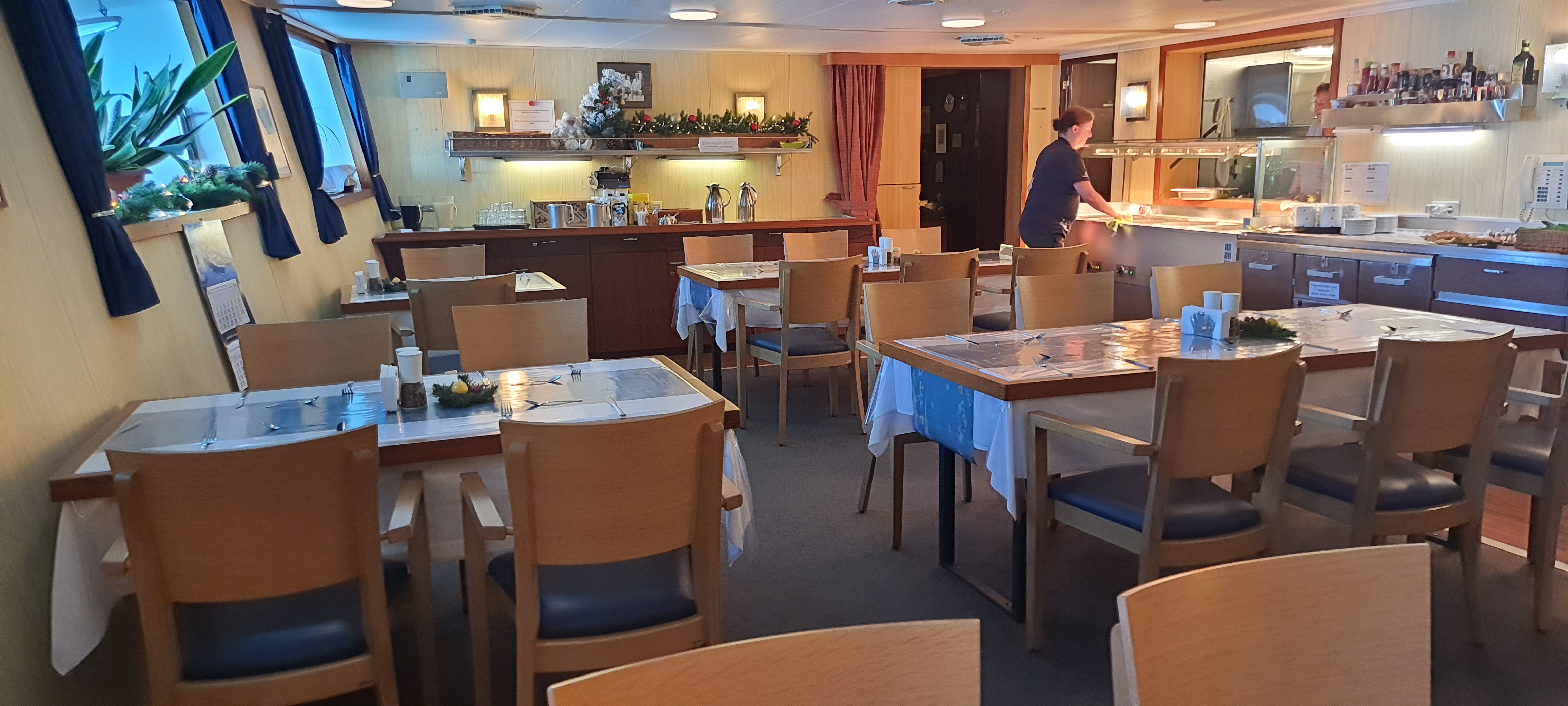
Throughout the day, with such a lot of energy being expended, the chief steward and her staff have to feed over 60 hungry mouths. The times may seem odd to some people, but we soon get used to breakfast at 07:15, lunch at 11:15 and dinner at 17:15. The food is both tasty and nutritious.
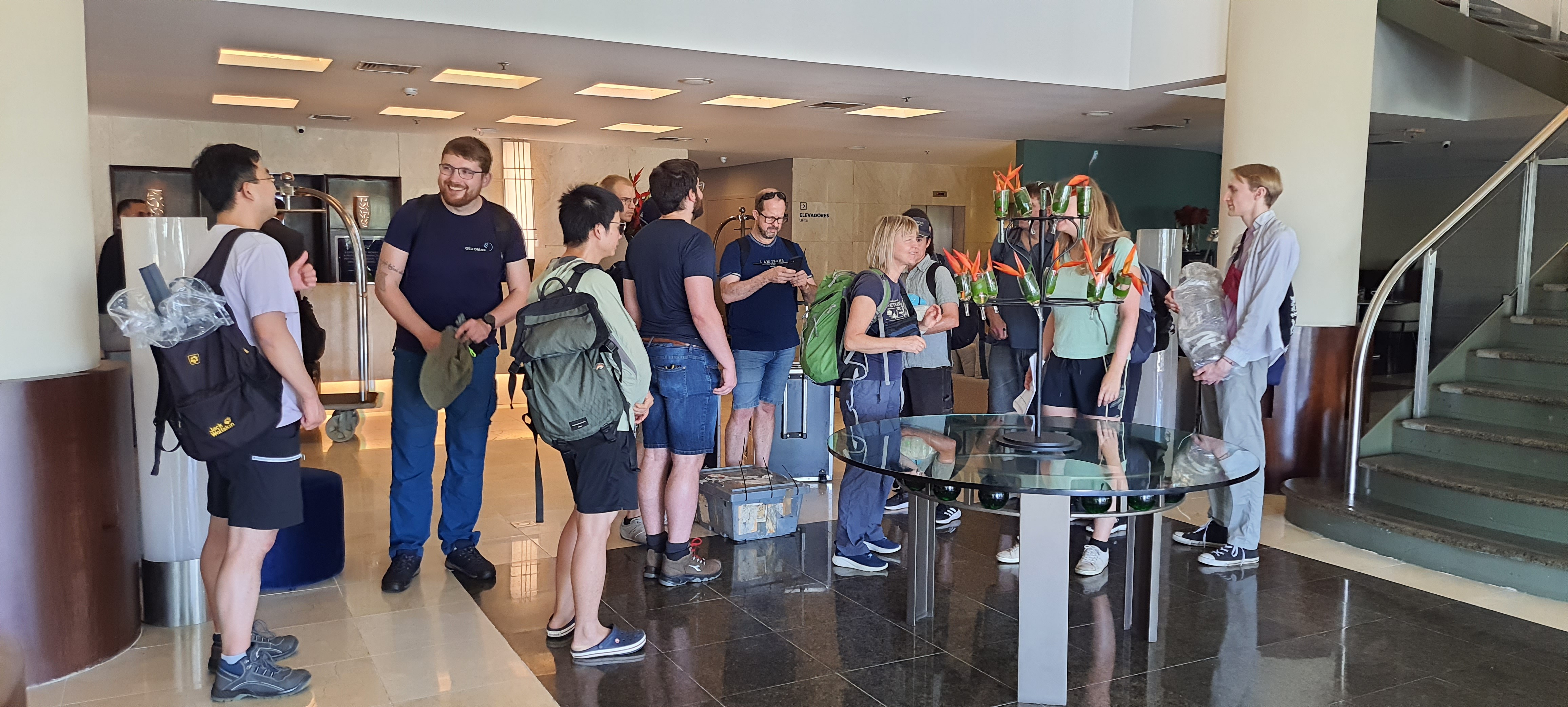
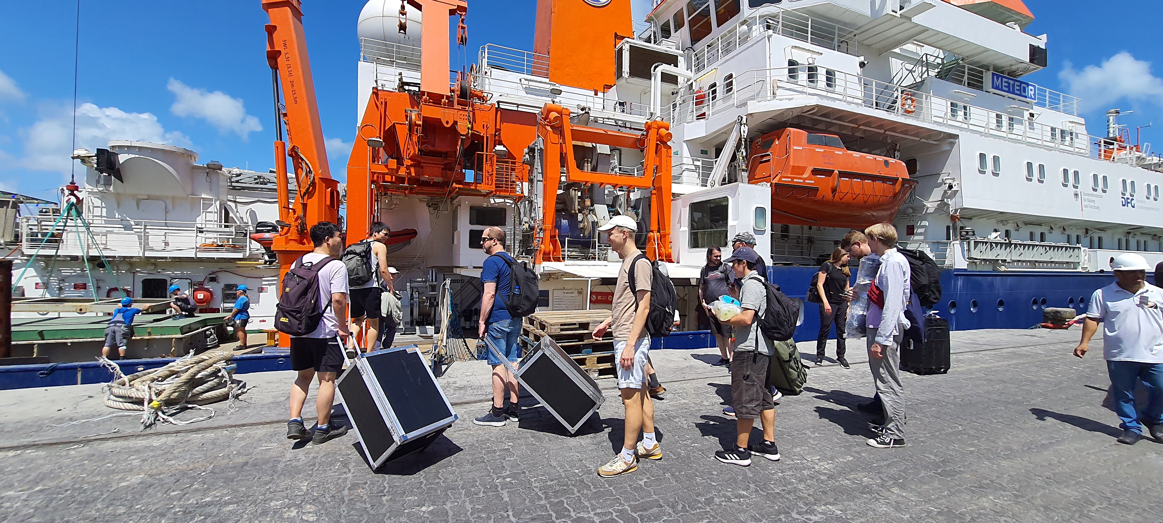
It has been a busy two days – and we haven’t even left port yet! Firstly, there was equipment to get aboard and stow, and a reception to be organised for local German and Brazilian dignitaries. This included a presentation by the scientists, a tour of the ship and some canapés on the main deck. It all went very well, and we were pleased that all our visitors enjoyed being tested on what they had learned with a short Kahoot, before being taken around and shown what a great ship and crew we have to look after the cruise. Many thanks to all who honoured us with their presence.
The following day, all the scientists embarked early in order to begin the task of moving specific equipment and supplies into the labs that will function as hubs for all their analytical work. We also had important meetings with the Chief Scientist, the Captain and the ship’s Safety Officer. This included a short tour of the ship to show us the relevant safety stations, lifeboats and life rafts. We hope these will not be necessary, but it is important to know how to act and where to go in the event of need.
It is late afternoon now and everyone is still at work setting up their posts in the labs, and preparing for the long sampling run ahead. This will begin tomorrow, as soon as we leave port, interrupted only by more safety training. Details of individual labs and the work of all the groups will be coming soon – bookmark us to find out more!

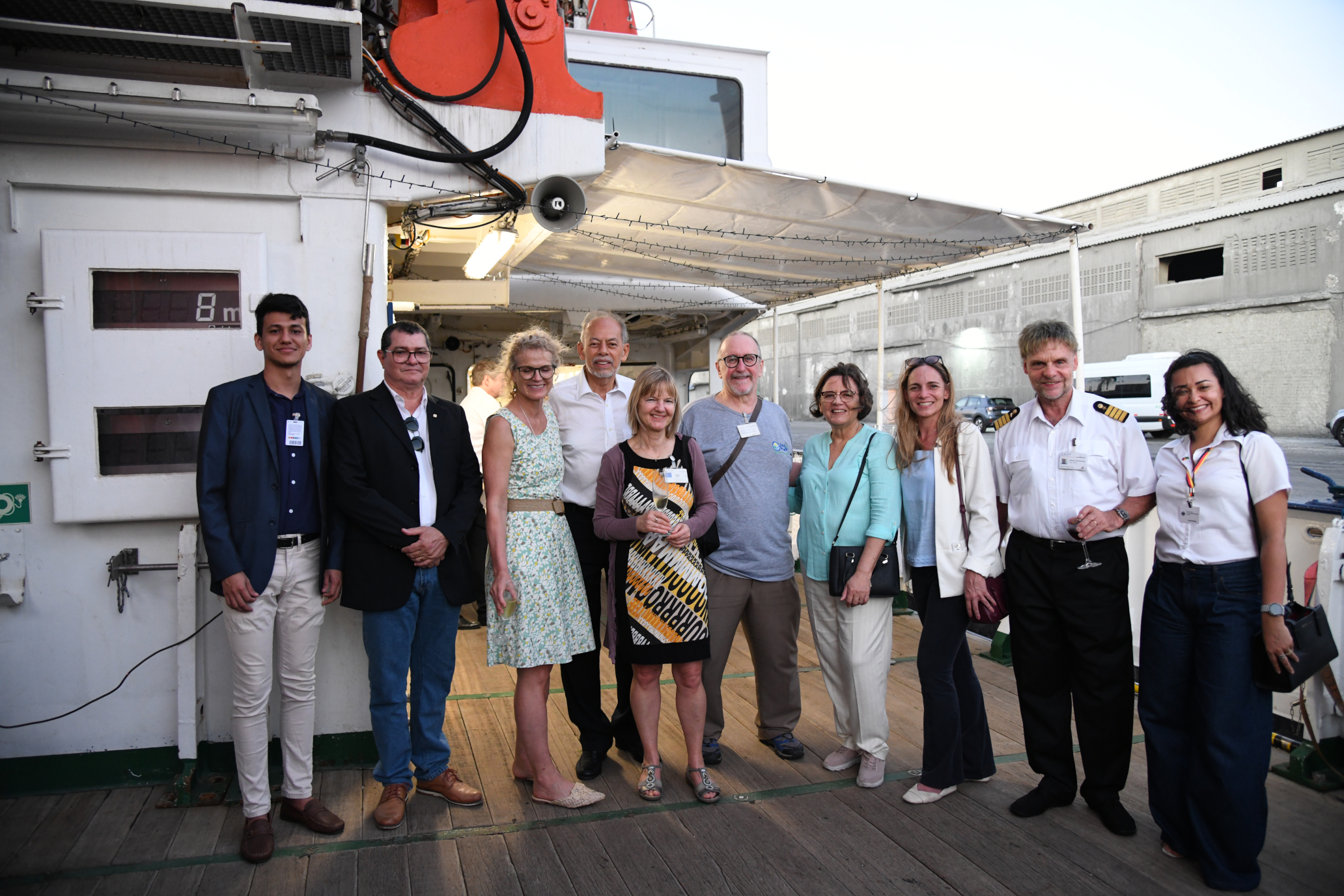
All photos Clive Maguire except ‘Reception’ and ‘Presentation of M206’ – Photos Mark Zindorf, with thanks.
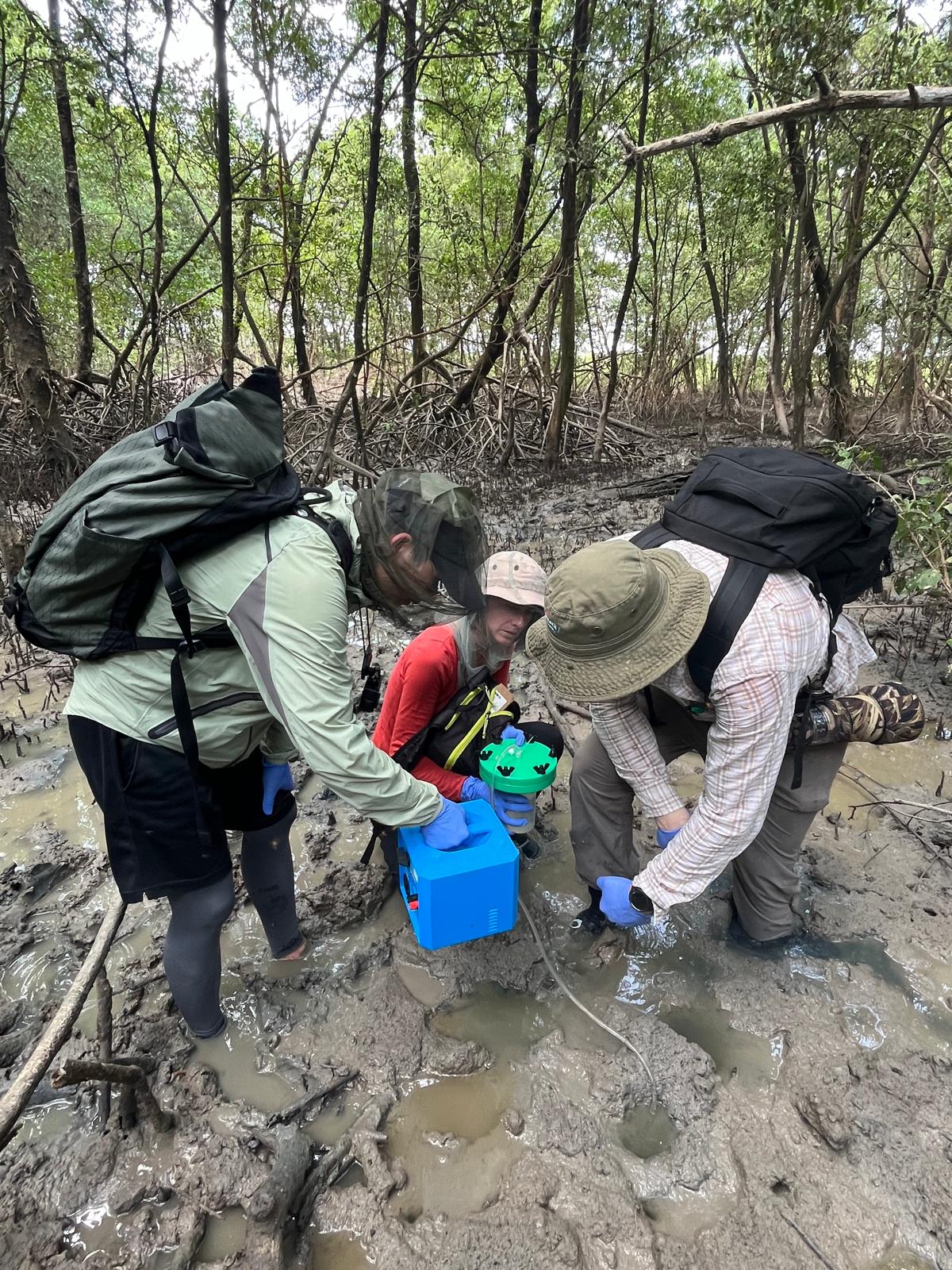
Never let it be said that scientists are afraid of getting their hands dirty. Whether it’s wading knee-deep in mud or standing waist deep-in murky waters, it’s all in a day’s work for the dedicated team of scientists of the PROBRAL project. Drawn from Germany and Brazil (Constructor University Bremen, GEOMAR, the University of Oldenburg, Universidade Federal do Pará, and Universidade Estadual do Norte Fluminense) they teamed up this month to analyse water from mangroves, rivers and estuaries in North Brazil.
Metals like copper and iron are naturally present throughout oceans, rivers and estuaries, and can act as both nutrients and toxins to living organisms. The behaviour of the metals is influenced by their size (e.g. are they large particles or dissolved?) and other components of water chemistry, such as salinity, pH (how acidic is the water?) and the presence of dissolved organic matter. Rivers and estuaries are often rich in organic (carbon-based) matter from plants and soil. Dissolved organic matter often binds to metal ions (when this happens, it’s called a “ligand”), and this can influence their bioavailability (how readily they can be taken up by living organisms).

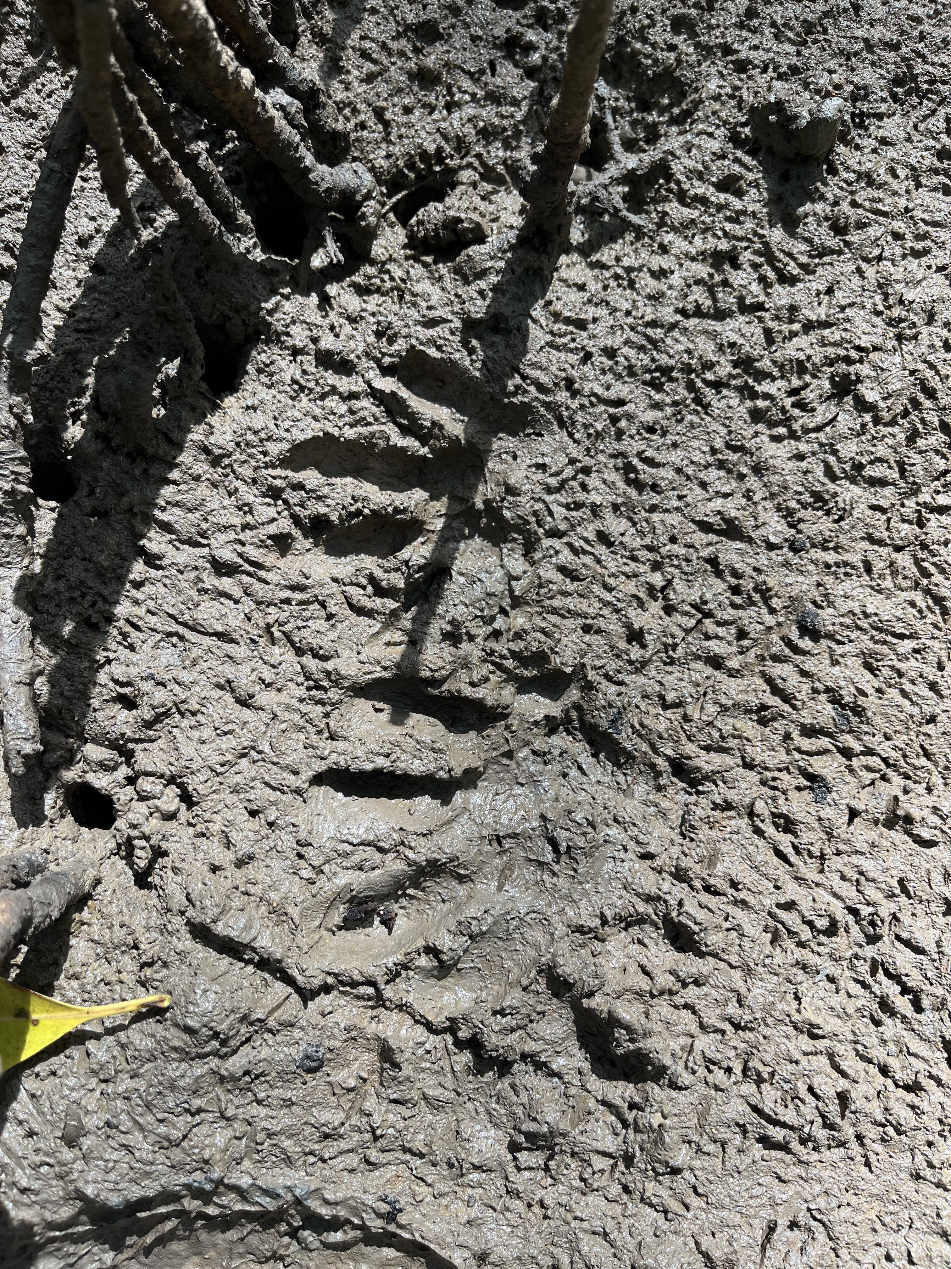
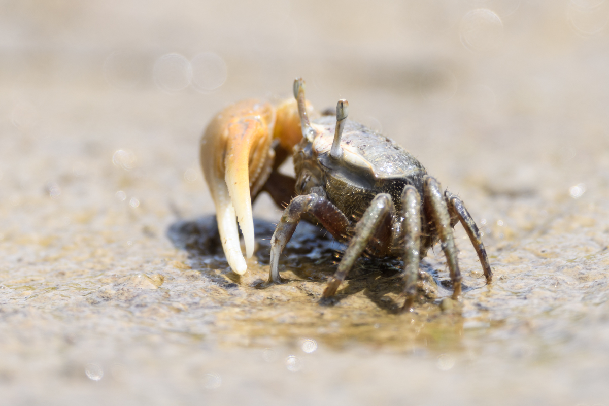
Mangrove swamps are a rich source of dissolved organic matter, nutrients and some metals. The team sampled porewater (water that collects in the ground in the tiny gaps between particles of soil) in both degraded and healthy mangroves. We sampled by digging holes and collecting the water that filled them. Even at low tide, we had to stomp through heavy mud, often sinking in to our knees. We saw lots of tiny crabs, birds, and even a monkey!
We also visited several creeks and rivers, especially the Caeté River that runs through Braganca and northern Brazil in the state of Pará. The Caeté is influenced by diurnal (twice daily) tides, resulting in salinity that changes throughout the day in the regions nearer to the coast. We sampled at multiple sites across the whole salinity gradient, from coastal waters (salinity 35, like seawater), to brackish estuary waters, and riverine freshwater (salinity 0). We sampled both by boat in the Caeté Bay, and from land in the inland rivers and creeks.
The PROBRAL campaign will generate lots of great data that will contribute to the M206 cruise, also examining trace metals and organic matter in the Amazon and Pará River estuary, as well as near coastal mangroves to the south-east.


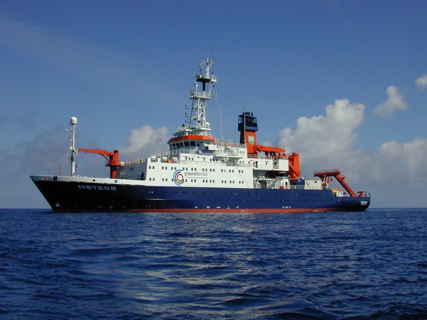
On 30th November, the Amazon Geotraces-2 interdisciplinary research cruise M206, with RV Meteor, led by Prof. Andrea Koschinsky of Constructor University will sail from the Brazilian port of Fortaleza to begin work examining the distribution of trace elements, organic matter and isotopes discharged into the Atlantic from the Amazon’s mouth. The cruise is carried out in collaboration with GEOMAR in Kiel, the University of Oldenburg, the University of Hamburg, and the Brazilian Universities Universidade Estadual do Norte Fluminense, Universidade Federal de Santa Maria and Universidade Federal do Rio Grande do Sul.
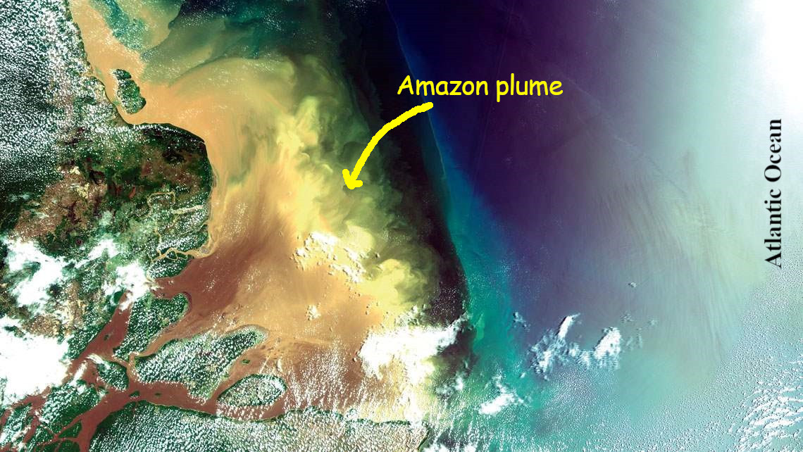
The Amazon River is almost 7.000 km long and in the wet season transports an incredible 300,000 cubic metres of water into the Atlantic Ocean every second. It is responsible for about 20% of the world’s fresh water entering the ocean, and the water spreads into the ocean in a huge plume covering an area of 80,000 square kilometres. As it pushes into the sea, it brings with it huge quantities of trace metals such as iron and copper and dissolved organic materials, and it is these materials and the processes they undergo during mixing of river water and seawater that interest the team.
“We need a much better understanding of the material cycle in the ocean,” says Prof. Koschinsky about the research trip’s aims. “We will only be able to reliably predict the human impact on the cycle if we can succeed in this.” Elements such as carbon, nitrogen, and phosphorus play an important role in our oceans, as they are essential elements for the formation of biomass. However, all life needs iron – even the smallest marine organism. In addition, many other trace elements such as copper, cobalt and zinc are essential while some other elements such as mercury are toxic elements of high environmental concern.
This is the second time the team will have studied the area. In 2018, they visited during the wet season, and this year they will study what happens in the dry season. They will take comparative water and sediment samples throughout the plume area and beyond, at depths from less than 100m to more than 2,000m and across the mixing area from pure seawater to pure freshwater. The research is very important, particularly now, when the whole of the Amazon region has experienced the worst drought in living memory. Humans are intervening in the fragile ecosystem of the Amazon and changing it significantly by building dams and through deforestation, and intensive agriculture. In addition, climate change will alter the fluxes from the Amazon to the ocean. All of this will in turn impact the biological productivity and health of the coastal ocean.
This cruise is an acknowledged process study (cruise number GApr21) of the international GEOTRACES program carried out by teams from 35 countries. For M206, Brazilian team members will play a critical role in the analysis of trace metals and microbial diversity, and the results of the research will feed into the wider global Geotraces programme that seeks to fill our knowledge gaps in trace metals and their isotope in the global oceans and help us understand the marine biogeochemical cycles. Ultimately, it is part of the jigsaw that contributes to our understanding of ocean ecosystems, the global carbon cycle, climate change and the earth’s ocean currents.
This year we are focused on helping young learners and their teachers engage with M206, Geotraces, and the wider geoscientific community. In addition to adding regular blog posts here, we will be adding posts we hope students and teachers will find interesting, and building up an online library of free factsheets, fun activities and quizzes, lessons/lesson plans, links and other useful or fun material. Bookmark and keep an eye on the blog, or take a look at our young learner pages here.