The Porewater Paradox

Pará River comparison showing sediment-heavy, brown water in 2018 and current plankton-rich water.

Since conducting my PhD research on the Amazon and Pará River estuary in the wet season, the river mouth, together with the mangrove belt to the south, has been an area of special interest for me. I recently participated in the land-based PROBRAL campaign to collect water from the mangroves and smaller rivers such as the Caeté (see Mud and Mosquitoes).


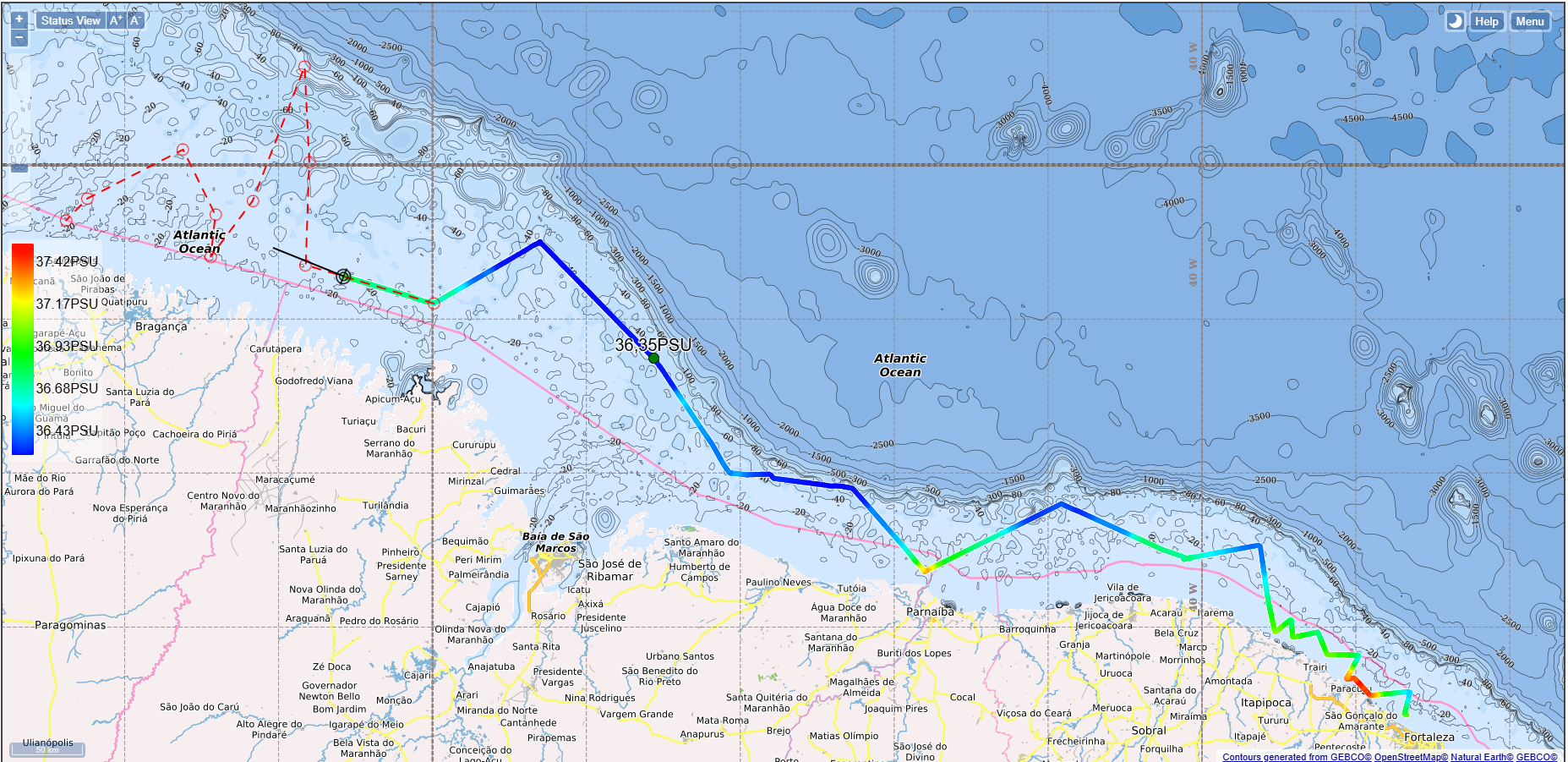
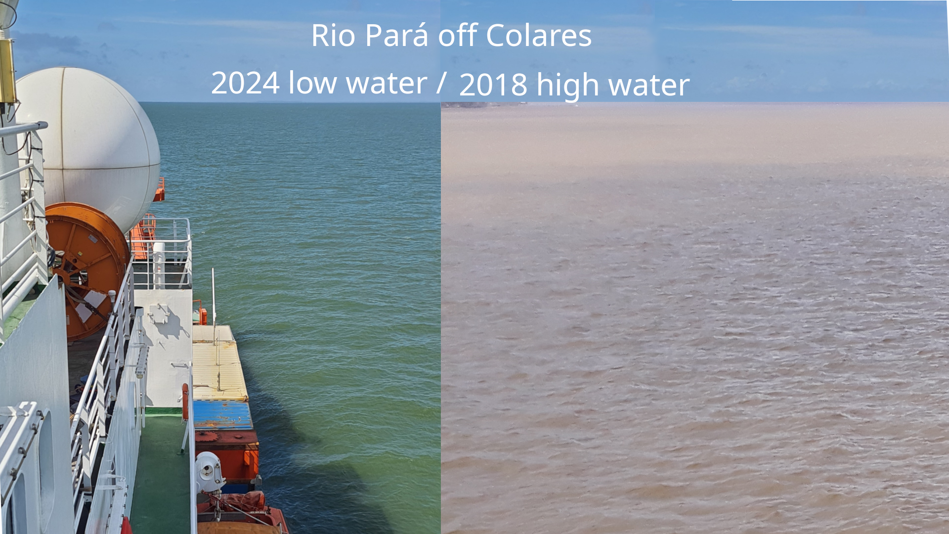
M206 will add to the results gleaned from research on previous wet-season cruises (M147 in 2018, and M174 in 2021) by gathering a much-needed dataset for the dry season, since the Amazon and Pará River flows vary dramatically in volume (from 120 000 m3/s to 240 000 m3/s for the Amazon; 38 000 m3/s to 9 000 m3/s for the Pará). We have not yet entered the Amazon River estuary itself on M206, but we see is a striking visual difference on the Pará today compared to its appearance in the 2018 wet season (April/May).

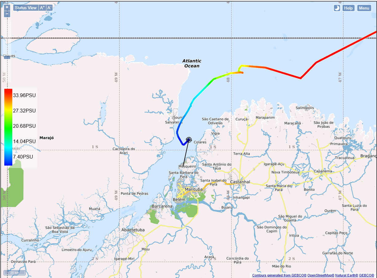
In addition, we have made a more extensive transect along the mangrove region in cruise M206 compared to M147 and M174, in some cases running parallel to the region where the PROBRAL samples were collected. The paradoxically higher salinity near the coast in the mangrove-belt region of M206 (as reported in earlier blogs) may reflect what we observed in the mangrove porewater collected during PROBRAL 2-3 weeks ago, which was sometimes much higher than seawater (up to 65 PSU).

Collecting water samples from the Trace Metal CTD (in background)

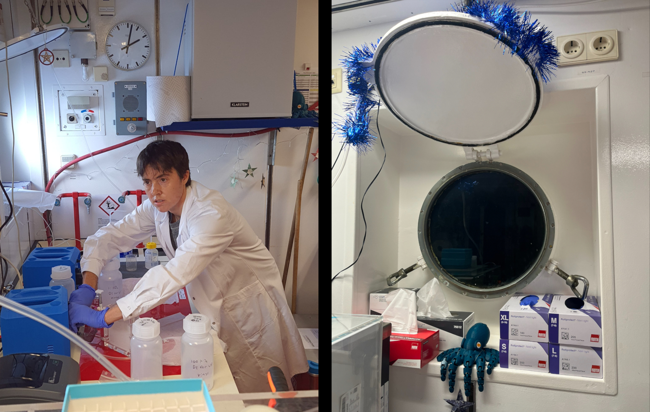
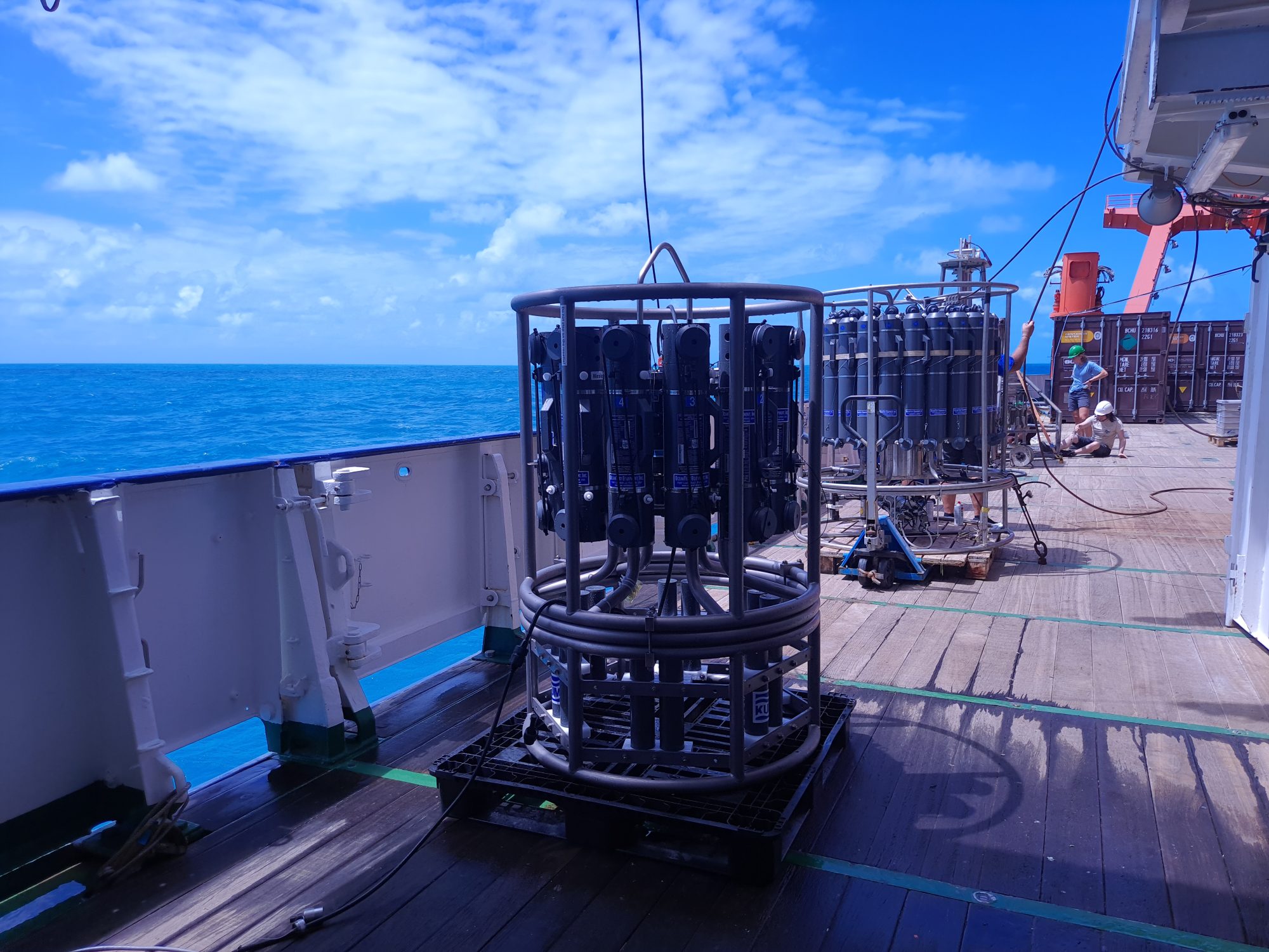
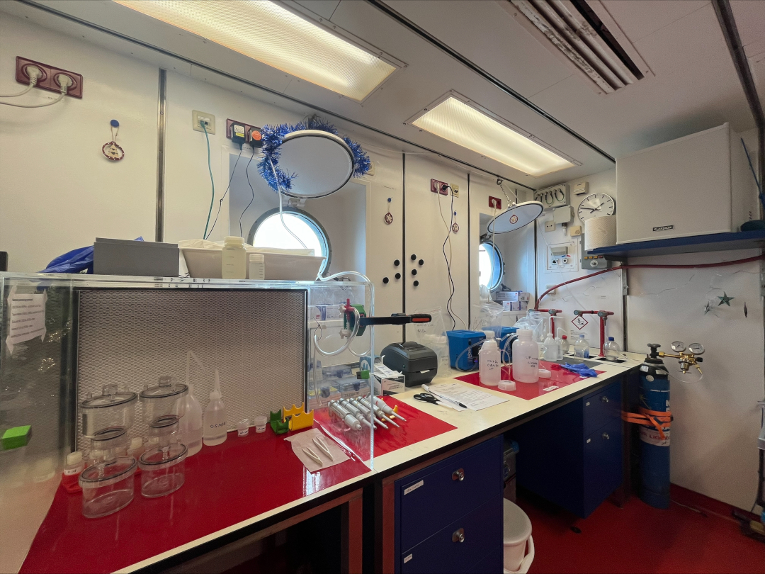
Our previous research on the Amazon-Pará estuary has focused on trace metals (Fe, Co, Ni, Cu, Zn, Cd, Pb) and metal-organic matter interaction. Metals such as Fe, Co, Ni and Zn are heavily complexed to organic matter (a.k.a. organic ligands), which can influence their solubility, toxicity, and bioavailability. In addition, metals and organic matter come in different sizes, which influences how much they remain in the water column and eventually reach the ocean during estuary mixing. On the ship lab on M206 as well as PROBRAL, my own work has focused primarily on filtering and processing seawater samples for trace metals, Cu and Ni-binding organic ligands, humic substances (a major fraction of terrestrially-derived organic ligands) and dissolved organic carbon. In addition to the samples that are already filtered by the team in the clean bubble, we also do further filtering at different pore sizes..

This data, combined with the bottom-water and MUC data, will provide a clearer picture of the processes taking place throughout the water column and salinity gradient during estuary mixing.

Um Dia Lindo para Pesquisas no Rio Pará

Um dia cheio hoje, enquanto partimos da foz do Rio Pará, próximo a Belém, para uma viagem de 10 horas com estações de amostragem ao longo de todo o transecto.

River Pará at approximately the same location in 2024 (low water) and 2018 (high water).

Trazidos aqui, como sempre, com timing e posicionamento perfeitos pelo Capitão Rainer e sua equipe, começamos a partir de um ponto próximo à vila principal da ilha de Colares (população de 12.000, famosa pelos avistamentos de OVNIs em Colares em 1977), nosso cronograma começa com um conjunto completo de estações a partir das 09h45, horário local. Isso incluirá o MUC, onde podemos (razoavelmente) esperar encontrar algumas amostras interessantes desta vez. Fotos a seguir!

ET in Pará
Foto: Mauro Ângelo/ Diário do Pará.

Enquanto navegávamos rio acima, foi fascinante observar que a água permanece relativamente verde, mesmo agora, apenas 90 minutos após a maré baixa, apesar de a salinidade estar diminuindo, como era esperado (veja o mapa). Isso contrasta bastante com o cruzeiro M147 em 2018, realizado durante a maré alta (veja a imagem inserida).

Station Plan 8
Track showing salinity gradient clearly

Local tides for today.

O tempo tem sido gentil conosco até agora, embora a previsão indique muita trovoada e relâmpagos. Por enquanto, porém, parece que estamos prontos para uma coleta de amostras proveitosa!

Ao Longo do Gradiente de Salinidade

Embora tenhamos tido alguns pequenos problemas com o uso inicial do equipamento de amostragem, isso foi previsto no planejamento da estação e está dentro do orçamento. Tudo já foi testado e está totalmente funcional. Apesar de que equipamentos sensíveis ainda possam apresentar desafios, a equipe está confiante de que quaisquer pequenos problemas serão resolvidos rapidamente.

Hoje e amanhã, estaremos trabalhando com todos os principais instrumentos de amostragem: o CTD, o MUC, o BWS, o TM-CTD e o tow fish (todos ilustrados). Há dois ótimos vídeos curtos que mostram os mecanismos do MUC e do CTD em operação debaixo d'água – um do Instituto Schmidt, aqui; e outro do Geotraces/PolarTREC, aqui. here; and the other from Geotraces/PolarTREC, here.

Trace metal (foreground) and normal CTDs on deck.
CTDs de metais traço (em primeiro plano) e normais no convés.

Nos movemos agora aproximadamente 300 milhas náuticas (550 km) para o oeste ao longo da costa, zig-zagueando para amostrar ao longo do gradiente de salinidade. É interessante observar que a salinidade é extremamente alta perto da costa dos manguezais (no mapa, o vermelho é o mais salino e o azul é o menos salino): não está claro se essa é uma condição normal durante o período de águas baixas ou se está exagerada devido à seca extrema vivida na região amazônica este ano.

Medições de salinidade mostrando maior salinidade próximo à costa de manguezais.

Interview with a young scientist

Interview with a young scientist

There are 30 scientists aboard, ranging in age from early twenties to …a lot older! Here, I am interviewing Caitlyn Kelly, from South Africa, who is studying at Constructor University and is on her first Geotraces research cruise. (By the way, we did the interview in the small library on board, using a gimbal to steady the camera, and you can see the strange effect this has on the image when the ship rolls a little). Please welcome Caitlyn..!

Caitlyn Kelly of Constructor University talks about M206

Brackish Water

Brackish Water

We will be navigating to the mouth of the Amazon and taking hundreds of samples of water as we go. We are looking at how the freshwater from the Amazon mixes with the sea water of the Atlantic, along what is called the ‘salinity gradient’.

We all know that the Amazon houses thousands and thousands of species of fauna and flora, some of them threatened with extinction. They include the infamous piranha, the capybara, the jaguar, the giant otter and giant anteater, the black caiman and the poison dart frog. However, at the mouth of the Amazon, little is known about the unique flora and fauna that can live in this environment where the saltiness of the water (the salinity) varies constantly with the tides and can range from 0 (no salt in the water – pure river water) to 7 or 10 on a scale where 35 is pure sea water.

Animals that can tolerate this strange environment are called ‘euryhaline’ (eury comes from the Greek, meaning ‘wide’ and haline is another word for saline), and probably the best known animal is the much-feared bull shark. A bull shark has reportedly been encountered more than 4,000km up the Amazon, but is equally at home in saltwater. Various eels are also known to tolerate salty and pure waters, and there are probably many other animals and plants that are unique to the river mouth.

The huge island at the mouth of the Amazon, Marajó, has 400 recorded species of bird, and 100 mammals. It is famous for its water buffalo, and has more buffalo than anywhere else in Brazil, with 430,000 head. It is used for an awful lot of things in Marajó, including day-to-day transport and for Police patrols, as famous explorer Pete Casey found out when he started his 7-year walk and swim up the Amazon!

Water buffalo in Pesqueiro, Marajó. Photo: Pete Casey, ascentoftheamazon.com

Perhaps we will spot a shark or a dolphin as we approach the Amazon – bookmark us and find out!

Começamos!

O Meteor desancorou esta manhã antes das 09:00 e agora estamos navegando para nossa primeira estação de amostragem. Estamos deixando a costa 10 km para trás, e, sob o sol brilhante, a água está muito azul. Esperamos encontrar primeiro água verde e, em seguida, água marrom à medida que seguimos para o norte e nos aproximamos da foz do rio Amazonas. Ao nos aproximarmos de nossas estações na região dos manguezais e chegarmos a um ou dois quilômetros da costa, também poderemos observar uma mudança na cor da água.

Reunião de estação em andamento na sala de conferências.

Enquanto isso os cientistas têm trabalhado arduamente, e a maior parte dos equipamentos e laboratórios já está organizada e pronta para as estações de amostragem. Isso inclui os amostradores CTD e MUC, que detalharemos nas próximas postagens. Há uma grande expectativa a bordo enquanto começamos nosso trabalho de forma efetiva, o que exige um planejamento cuidadoso para aproveitar ao máximo o tempo e os recursos. Já estão sendo realizados processos de filtragem e análise de amostras de água coletadas durante o programa PROBAL, pouco antes do M206. Neste momento, uma reunião de estação está em andamento para discutir os detalhes do uso correto dos equipamentos para a primeira estação amanhã de manhã às 08:20.

Nossas localizações aproximadas após sair de Fortaleza.

Do lado de fora, o trabalho continua dia e noite para o capitão e a tripulação. Embora estejamos no início da estação chuvosa na Amazônia, aqui, mais ao sul, temos sol de ponta a ponta, e as temperaturas, mesmo a 10 km da costa, estão em torno de 30 graus, e muito mais se você não estiver na sombra. Precisamos ter cuidado e tomar as devidas precauções ao ir ao convés por qualquer período de tempo.

Durante todo o dia, com tanta energia sendo gasta, a chefe de comissaria e sua equipe precisam alimentar mais de 60 bocas famintas. Os horários podem parecer estranhos para algumas pessoas, mas logo nos acostumamos com o café da manhã às 07:15, o almoço às 11:15 e o jantar às 17:15. A comida é tanto saborosa quanto nutritiva.

  • On the menu today...