Today my guest is Mariana Freitas de Souza, who joins me on the last day of the M206 cruise to tell me a little about herself, her work and her career.
Many thanks Mariana!
Posts for young learners – of all ages!

Today my guest is Mariana Freitas de Souza, who joins me on the last day of the M206 cruise to tell me a little about herself, her work and her career.
Many thanks Mariana!

Today, I am joined by Alana Delatorre, who talks to me about her role on board the Meteor and her budding career in biogeochemistry. Many thanks to her for taking time out of her busy sampling schedule to talk to me!

Today I am joined by Elias Lilie, who talks to me about why he chose his career path, and what he has been doing aboard the RV Meteor. Thanks Elias!

1. …that the oceans have holes and bumps in them?
Neele Sander recently explained more to me after she had presented some of her initial observations to her colleagues aboard the RV Meteor.
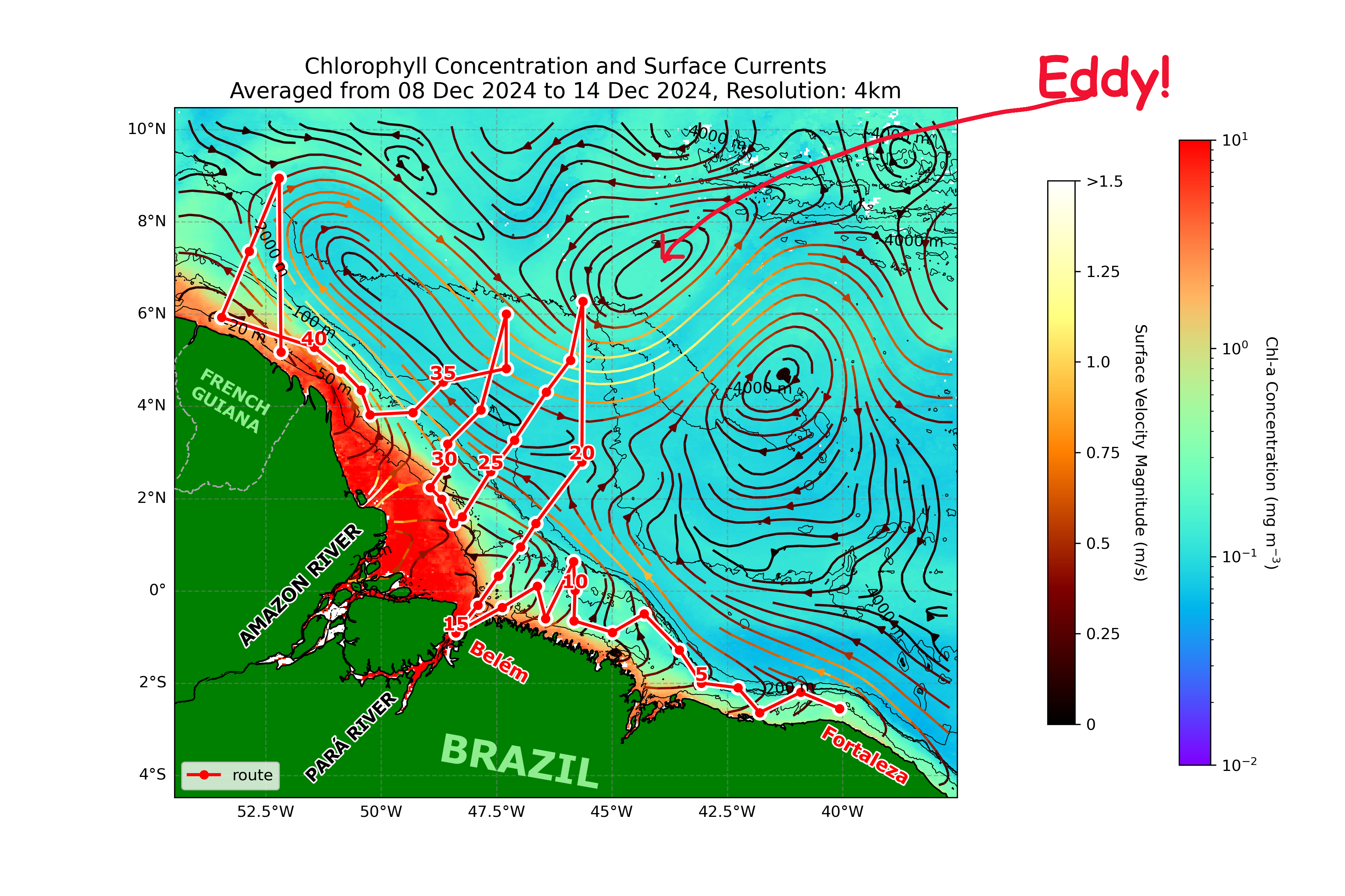
The oceans are in constant movement, and the patterns of movement are known as the currents. However, sometimes something interrupts the general flow of the currents, and the water begins to circulate in an eddy that can be very large indeed.
In her recent work for M206 Amazon-Geotraces 2, Neele observed one such eddy, which can be seen in the satellite image (right). She told me that it measured around 100km across and that, in the middle, it formed a hole (okay, a ‘depression’, of around 30cm!). The movement of the eddy where she made the observation is circular, in a counter-clockwise, or ‘anti-cyclonic’ movement; but in the southern of half of the planet it would move around the other way – clockwise, or in a cyclonic movement. She also told me that some eddies can produce a rise in the water level so that it is higher than the surrounding sea – for me, that’s definitely a ‘bump’ in the ocean.
So, next time you’re looking across the sea, remember that it’s not all just one big flat surface – it has bumps and holes in it too!
2. …that the amount of river water entering the oceans is equivalent to 1,200,000,000 1-litre bottles of water every second?
If you prefer, this is 1,200,000,000 x 31,536,000 every year, which is… a lot! The Amazon makes up a big percentage of this, and it also carries billions of tons of nutrient-rich sediment into the ocean. That’s why the Amazon-Geotraces programme is putting together as much information as possible about how river water mixes with the sea water and how it is transported around the oceans.
3. …that the oceans store an immense amount of carbon and are a vital part of our carbon cycle?
The oceans are carbon reservoirs or ‘sinks’ that help maintain the balance of the planetary carbon cycle. Carbon is both a building block for all life, and a key part of our climate. There is a lot of important work being done to understand what happens to dissolved organic matter (DOM) and the carbon it contains, that flows into the sea from rivers and other areas like mangroves.
Michael Seidel, one of the scientists on the M206 Amazon-Geotraces programme, explained to me that the world’s oceans absorb and store 25% or more of our carbon emissions, and with existing carbon stores under threat from deforestation and the use of fossil fuels (forests, coal and oil deposits are are carbon sinks too), we must urgently understand what the impact of the changes will be on the ocean.
Thanks to Neele and Michael!
Now, can you put the other rivers below in the correct order for the amount of water they discharge into the oceans?

Check your answers on wikipedia or on our site here.
Don’t forget to have a look at the other resources available on our Young Learners Page

Today, I have Neele Sander with me, talking about her interest in climate physics as well as her responsibility for the operation of the CTD rosette equipment and what she has observed during the first part of the cruise. Many thanks to her for taking the time to talk to us!

The UNESCO Ocean Literacy Portal begins with these words:
"All the world’s oceans are connected, forming one huge body of saltwater, the Global Ocean. However, for geographical, historical and cultural factors, we usually divide it into five main ocean basins.

These are the Pacific, Atlantic, Indian, Arctic and Southern ocean basins. All together, they cover about 71% of the Earth’s surface and contain about 97% of all the water on the planet.
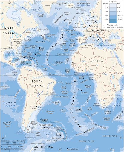
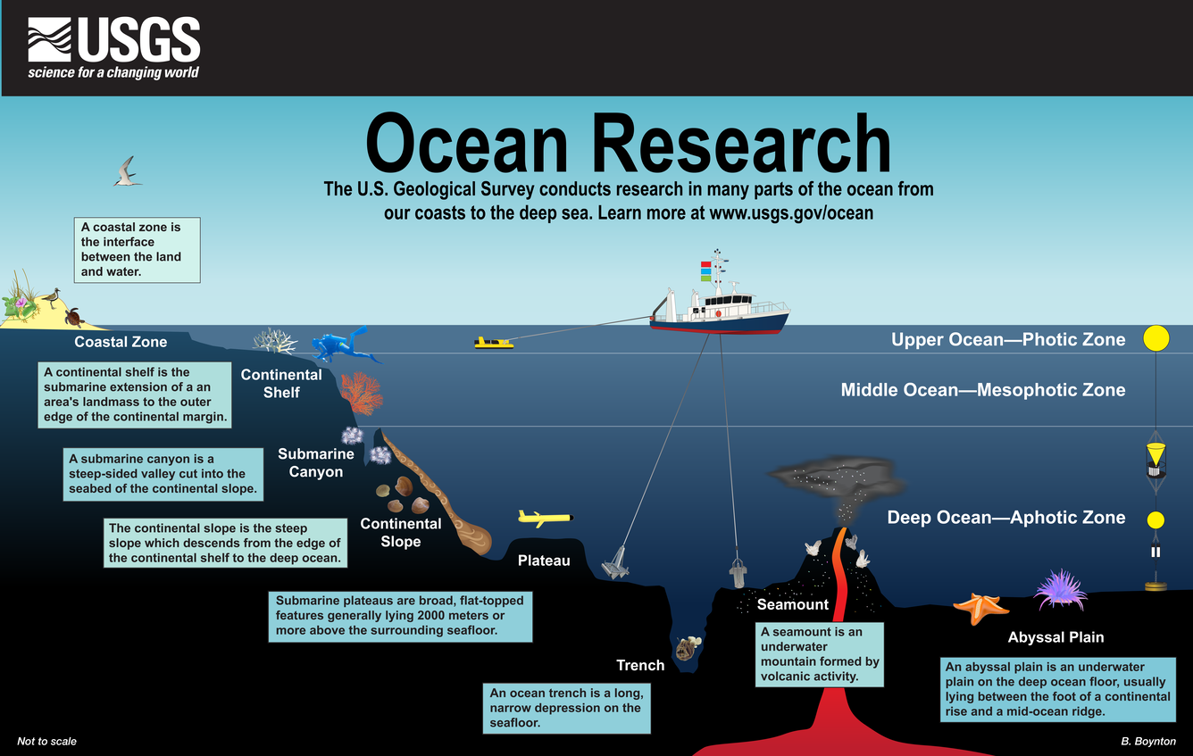
71% of the planet, it says. Nearly all the water on the planet. Difficult to imagine, right? Did you know that the oceans are up to 11,000m deep. Your local swimming pool is probably 3m at most. Have you ever climbed a ladder? A normal ladder is round 2m high, so let’s say you started climbing up from the sea bed on ladders. I bet you’d be pretty tired after climbing up the first ten, and I’m sure you’d need to take a long break after the first 100. It would need to be a long break, and you’d need some food and water to prepare yourself for the next… 5,400 ladders you’d need to climb to get to the surface!
This is why we still don’t know much about the bottom of the sea. It’s almost impossible for us to reach those depths – in fact only 3 people have ever made it to the deepest part.
The Ocean Literacy Portal goes on to tell us about the astounding amount of resources there are under the sea – minerals like oil, gas and coal; weird (and very valuable) things like the ferromanganese nodules our Chief Scientist Andrea Koschinsky was analysing at the start of her career. These and other rocks and concretions can contain copper, zinc, nickel, gold, silver, and platinum. There are other things in there too, though, including a vast and complex range of animal and plant life and an ecosystem we barely understand.
The Geotraces programme is helping to fill some of the gaps in our knowledge, but we’ve a long way to go. We don’t yet fully understand how the oceans circulate. We’ve only mapped around 10% of the oceans. Here are a few more things to think about:
The thing is, we’re going to need a lot more Geotraces-type studies and a lot more marine scientists if we are to understand and protect the oceans, and use its riches in a sustainable way. Have you thought that maybe you could be a marine scientist, exploring the oceans?
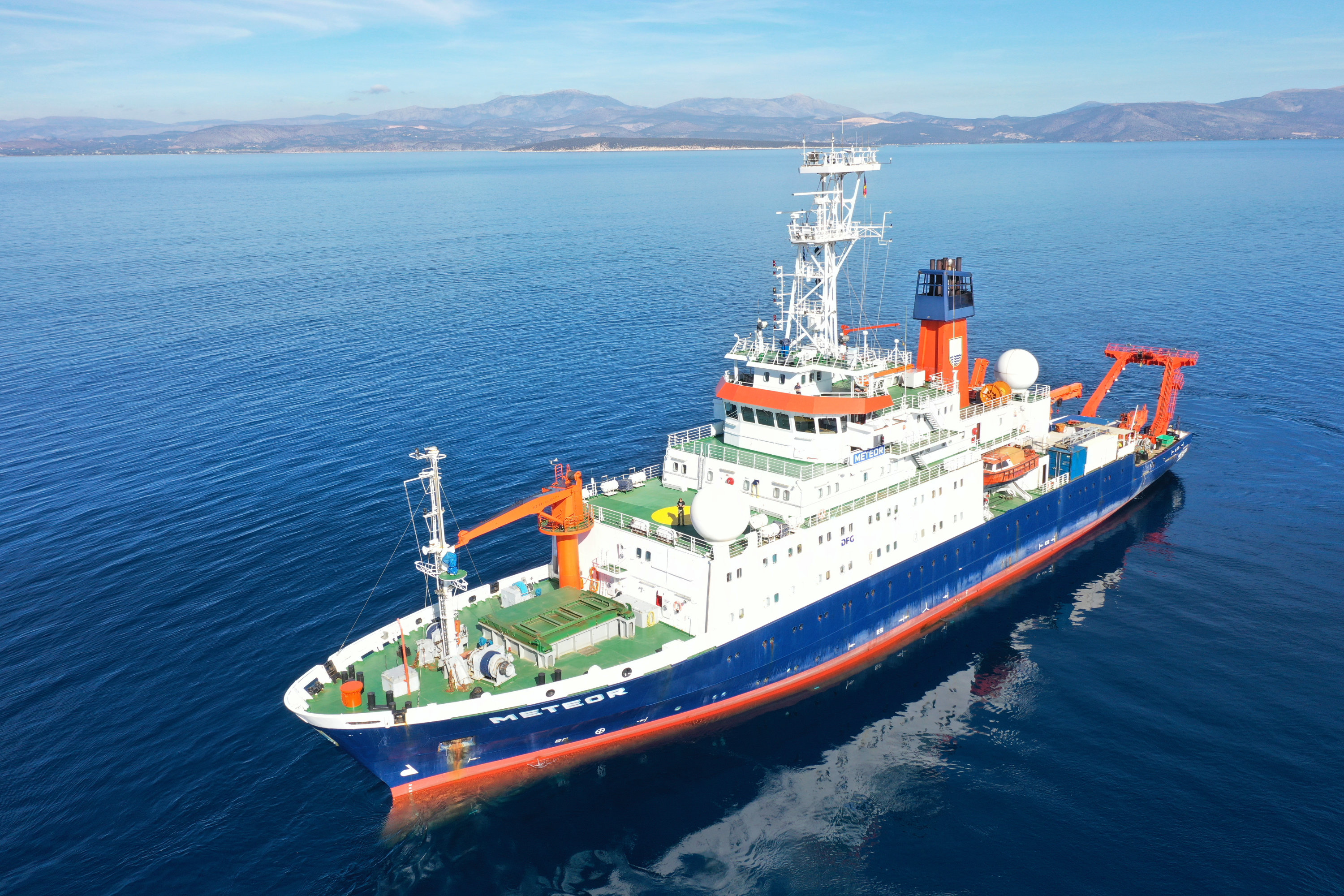
Since 2018, aboard the RV Meteor, the international project Amazon Geotraces has been looking at how the Amazon River, pouring on average 230,000 cubic metres of freshwater per second into the Atlantic, mixes with the seawater and affects the chemistry of the ocean. These studies are essential to help us learn about life in the oceans and how they circulate and how they affect our climate.
If you want to know more, take a look at the links below. They have some great resources for students and teachers alike. And when you’ve finished reading, try our Amazon Geotraces Oceans Kahoot quiz and see how much you know about the global oceans!

Today we have an interview with Professor Dr. Andrea Koschinsky, Chief Scientist on the M147 and M206 Amazon Geotraces cruises. Many thanks to her for agreeing to take a few minutes out of her busy schedule to give us her thoughts on the cruise so far, and tell us a little bit about how to become a chief scientist.

An interview with marine scientist Michael Seidel of the Institute for Chemistry and Biology of the Marine Environment. Many thanks to him for sharing something of his career and his passion for geosciences.

Our second interview is with Albert Firus of Geomar. Many thanks to him for telling us a bit about himself and his studies, and about his role on M206. As in the previous video, the gimbal mechanism on the camera was not disabled, so the motion of the ship is perceptible.

There are 30 scientists aboard, ranging in age from early twenties to …a lot older! Here, I am interviewing Caitlyn Kelly, from South Africa, who is studying at Constructor University and is on her first Geotraces research cruise. (By the way, we did the interview in the small library on board, using a gimbal to steady the camera, and you can see the strange effect this has on the image when the ship rolls a little). Please welcome Caitlyn..!